Xeset 1 Dam Hydropower Info - by Hobo Maps - Go to Hydropower Projects Page - - - Home
Xeset is pronounced as "Say set".
Xeset 1 Hydropower Project is located on the Xeset river in Lao Ngam District of southwestern Saravan Province of southern Lao PDR.
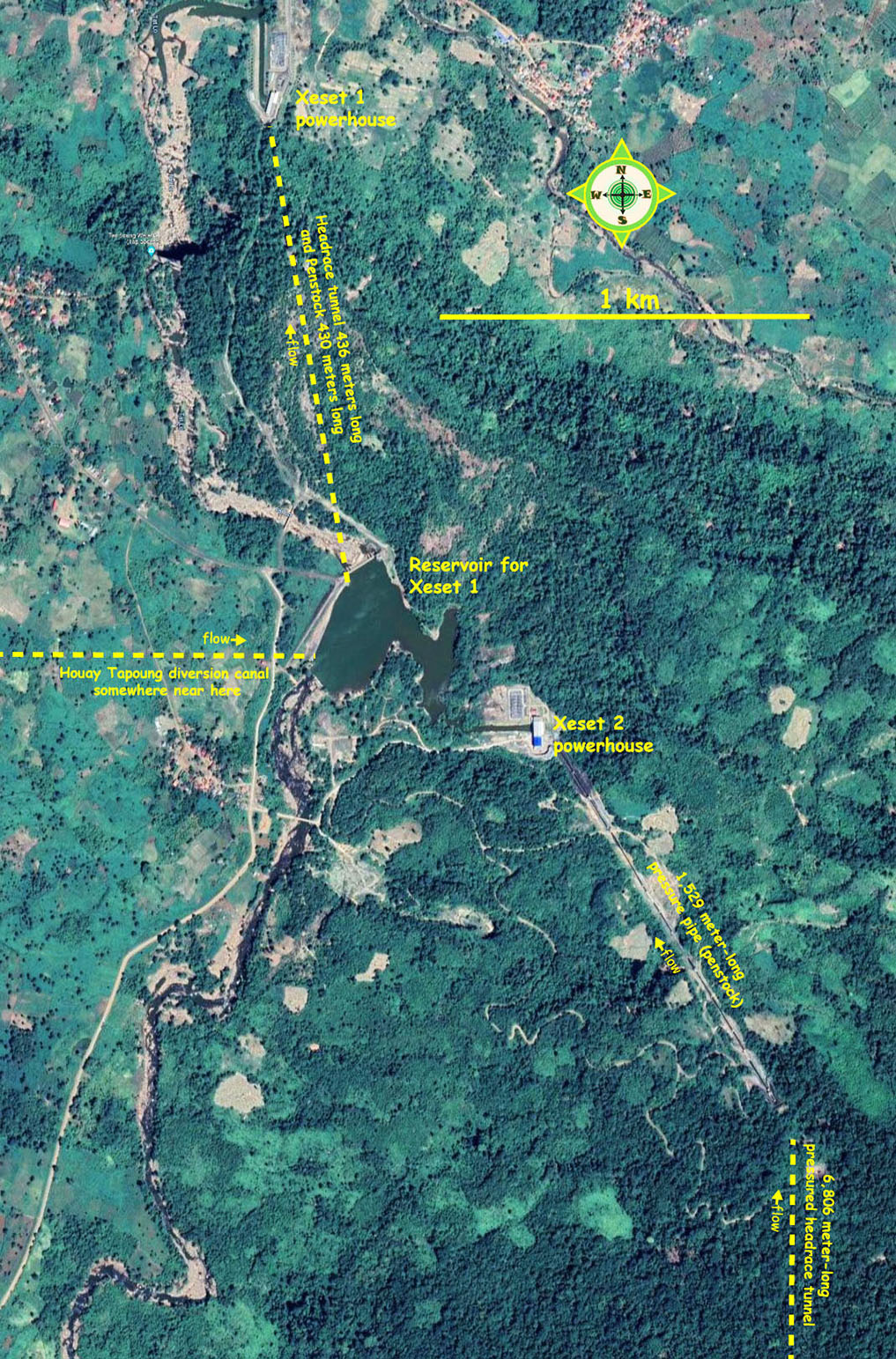
Xeset 1 & 2 projects are only 2 km apart at the location seen in image below:
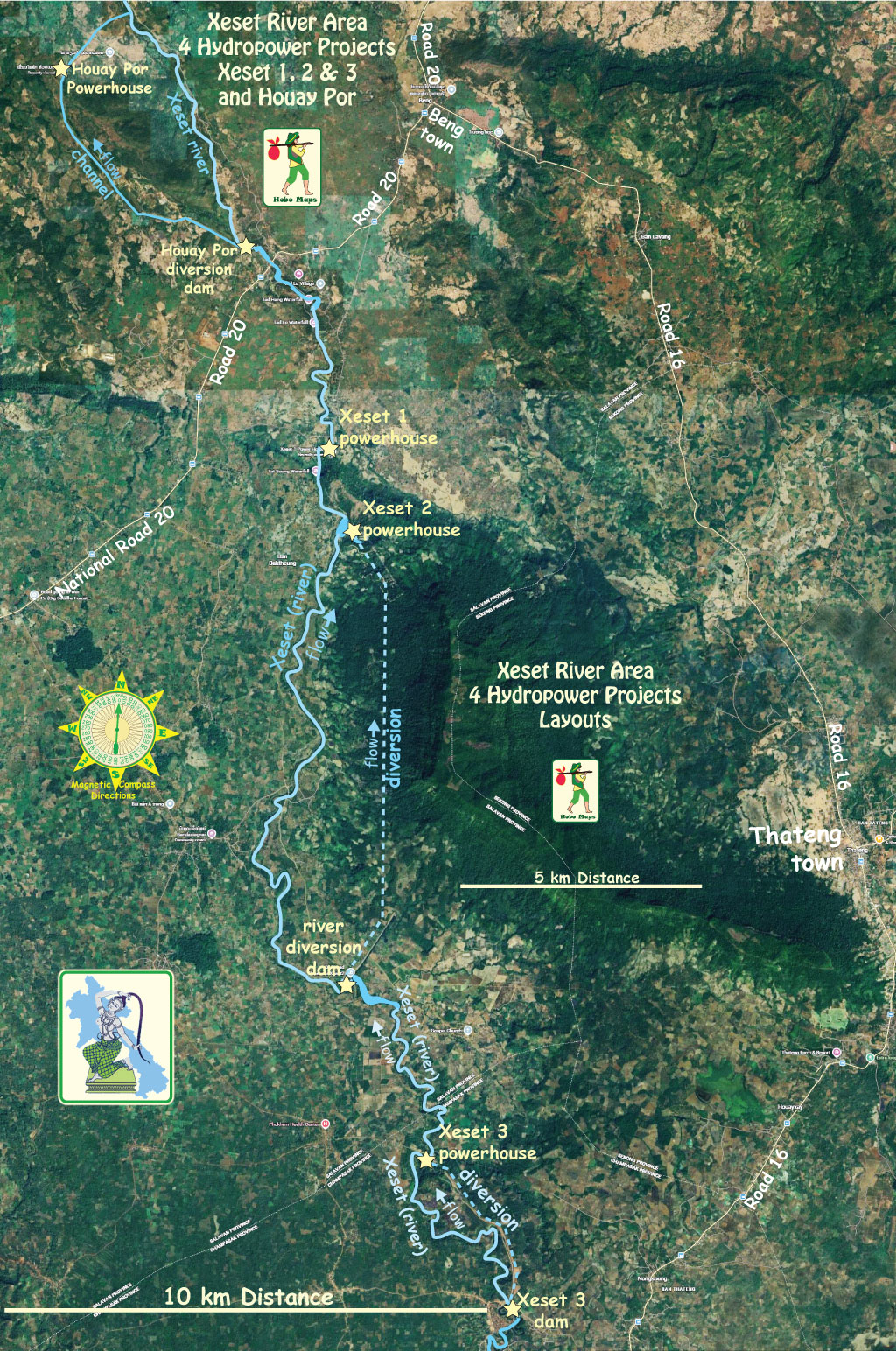
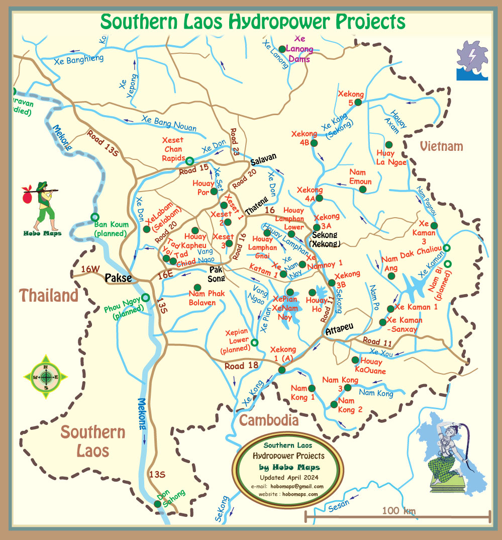
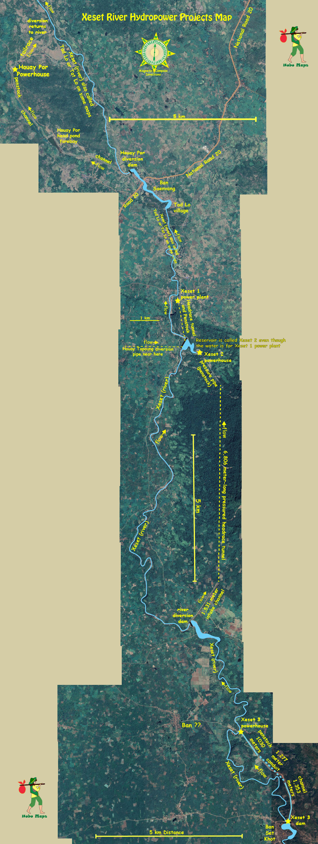
Houay Por & Xeset 1, 2 & 3 dams layout map below:
Xeset 1 & 2 hydropower project sites in image below:
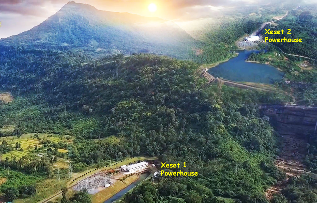
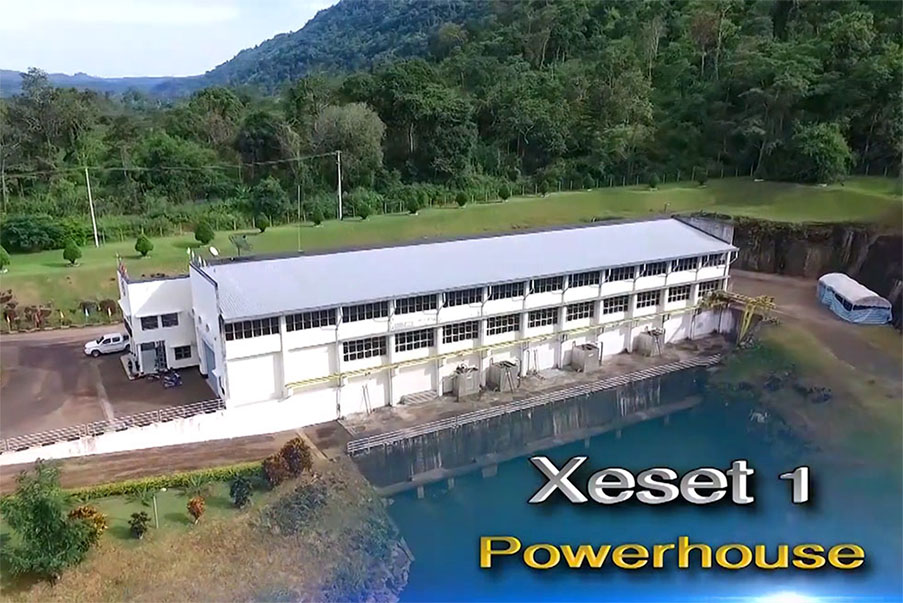
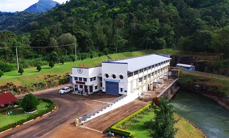
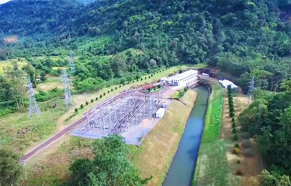
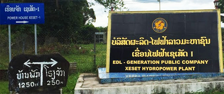
Xeset 1 power plant image below:

The Xeset 1 Hydropower Plant is a run-of-river style project with a head of 157 meters. The project has limited storage capacity and energy production can vary with the river flow from day to day.
Xeset 1 power house has five generating units: three with 13 MW capacity each and two units of 3 MW each for a total installed capacity of 45 MW. Annual output is estimated at 180 GWh for domestic consumption in Laos with the surplus exported to Thailand.
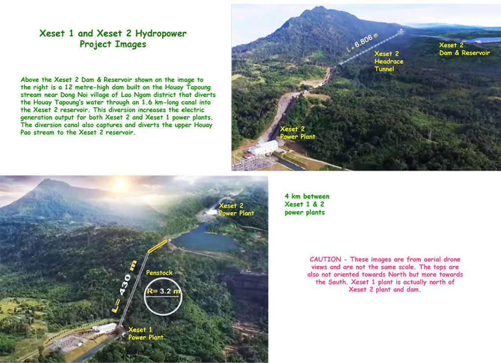
Xeset 1 & 2 Hydropower Projects are connected and share the same flow of water in part coming from the diversion of water from Houay Tapuong and other streams. These diversions pass thru the Xeset 2 powerhouse and then the Xeset 1 powerhouse generating electricity twice as shown in the image below.
The project is 100% owned and operated by EDL GEN and is one of the older hydropower plants in Laos. Since 1991 the project has been supplying electricity to Saravan and Champasak provinces in Laos with some surplus exported to Thailand.
Xeset Dam 1 is the first international hydropower collaboration project in Laos. It received loans from ADB and the World Bank, grants from United Nations Development Program (UNDP) and support from Sweden (SIDA) and Norwegian Government to finance the project.
Kvaerner Energy, Oslo Norway and ABB, Veseraas Sweden handled installation of the electro mechanical equipment. Thai-Italian was also a contractor.
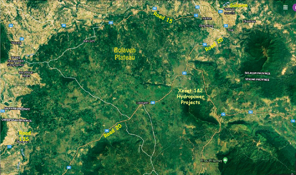
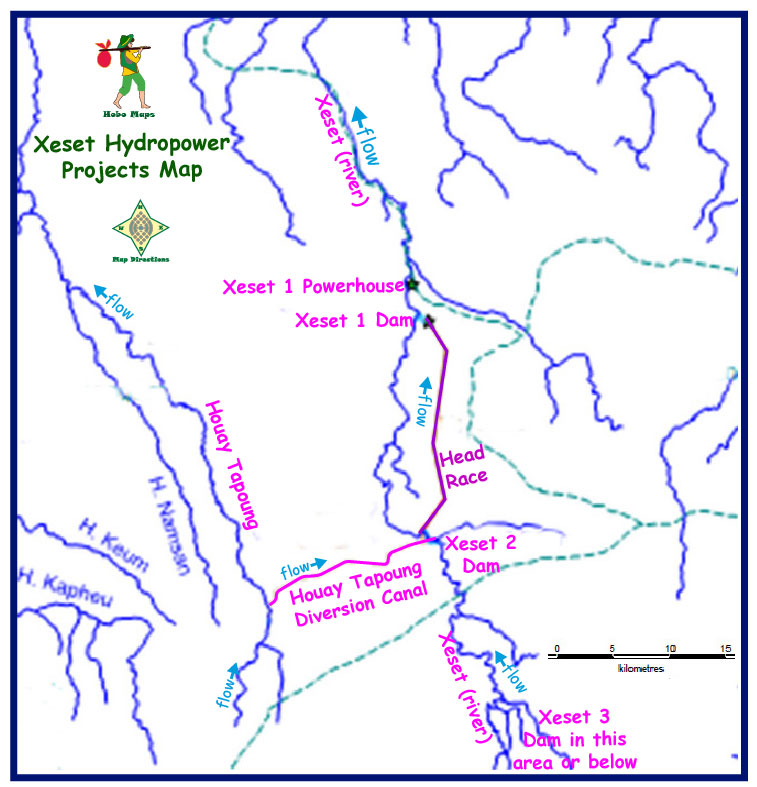
Xeset Hydropower Projects map below:
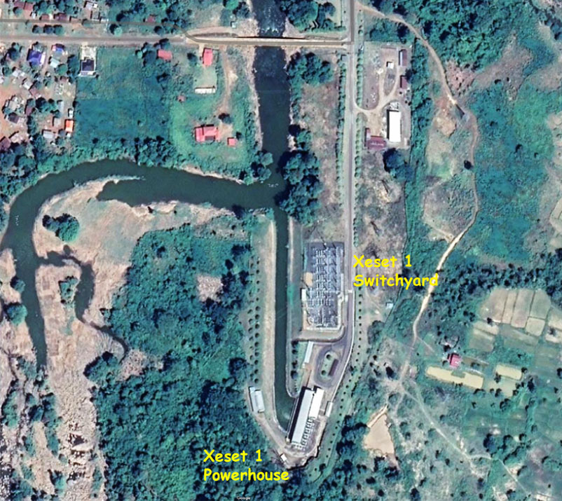
Satellite image view of Xeset 1 & 2 hydro projects layout below with the reservoir at coordinates - 15°29'28.6"N 106°16'48.8"E (15.491263, 106.280209):
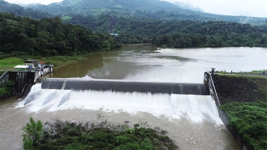
The Xeset 1 intake pond (head pond) is created by a 10 meter-high gravity dam weir. From the intake pond to the power house water is conveyed through underground tunnels partly steel-lined.
The 45 MW Xeset 1 hydropower project has a small reservoir and low dry-season flow volumes on the Set river result in low electricity generation.
The Xeset 2 and Xeset 3 dams & reservoir also increase water flow volumes for Xeset 1 downstream of Xeset 2 & 3. Extra water will enter Xeset 1 reservoir from the Xeset 2 project after being diverted from the Tapoung River into the Xeset 2 project.
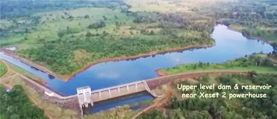
The upper level dam and reservoir of Xeset 1 & 2 is seen in image below:
Xeset 1 Power Station images below at coordinates - 15°30'11.3"N 106°16'37.1"E (15.503140, 106.276975):
The Xeset 1 and Xeset 2 powerhouses are connected via a 37 km long double-circuit 115 kV transmission line from the switchyard of Xeset 2 to the Paksong substation. Xeset 1 & 2 powerhouses are quite close together.
Xeset 1 plant image is proudly on the back of Lao 2,000 kip banknote:

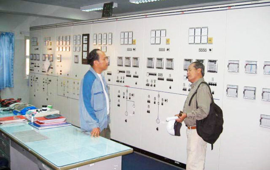
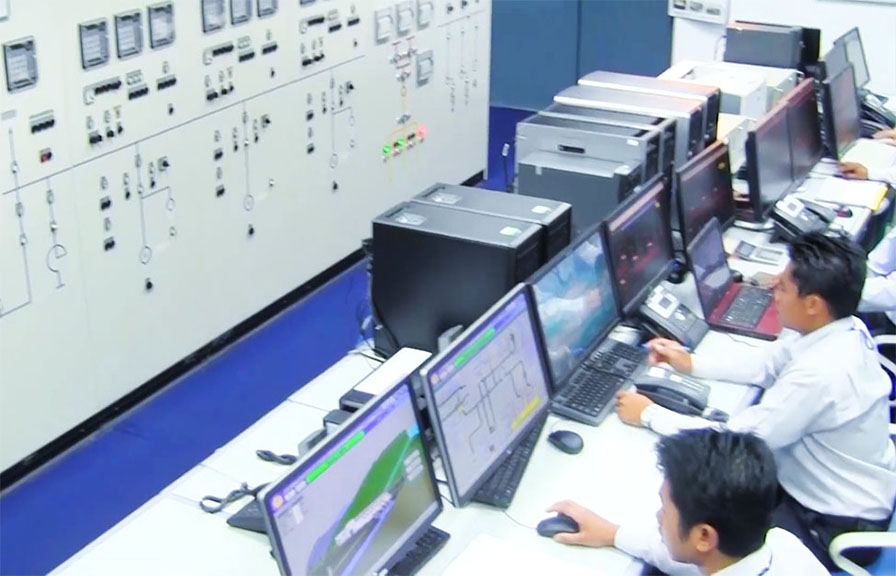
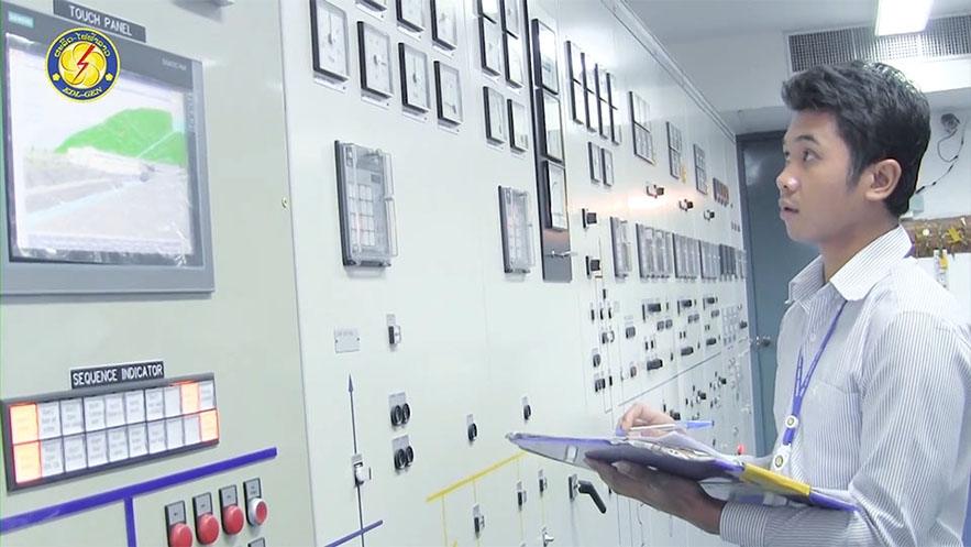
5 turbine-generator sets at Xeset 1 below:

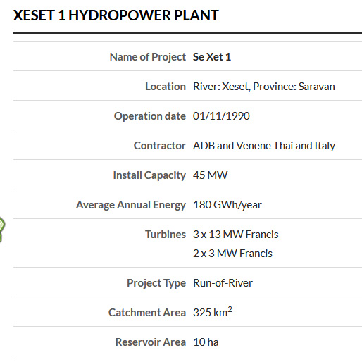
Technical information of Xeset 1 Hydropower Plant
1. Storage:
- Catchment area : 325 sq km
- Reservoir dead storage : 300,000 cubic meters
- Reservoir total storage : 370,000 cubic meters
- Full water level : 482 meters above sea level
- Low water level : 478 meters above sea level
2. Dam
- Height : 10 meters
- Length : 91 meters
3. Operation Discharge System
- Headrace tunnel length : 436 meters
- Headrace tunnel diameter : 3.2 meters
Maximum operation discharge No. 1 or 2 : 2.25 cubic meters per second
Maximum operation discharge No. 3, 4 or 5 : 9.5 cubic meters per second
4. Penstock 430 meters long and 3.2 meter inside diameter
--------------
Project - Xe Set 1 Hydropower Plant
Operator - EDL-GEN
Commercial Operation - 1990
Installed Capacity - 45 MW
Turbines - 3 x 13 MW Francis - 2 x 3 MW Francis
Catchment - 325 sq km
Dam Type - Run of River
--------------
Xeset 1 hydropower project is located in mid section of map below:
Xeset 1 Hydropower plant satellite images below at coordinates - 15°30'11.3"N 106°16'37.1"E (15.503140, 106.276975):
Xeset 1 weir image below
Xeset River Hydropower Projects map below shows Xeset 1, 2 & 3 hydropower projects in the lower area plus Houay Por project at the top - all on the XeSet (river):
Houay Por & Xeset 1, 2 & 3 dams layout map below:
Click to see larger scale version of this map below - Xeset Dams Map Large Scale
Good video for Xeset 1 & 2 projects in English HERE .
NOTE: In Southern Laos "Xe" means “River”. Since “Nam” also means “River” we wouldn’t normally say "Nam Xeset".