
Tad Yoi Dam Hydropower Info by Hobo Maps - Go to Hydropower Projects Page --- Home
The Tad Yoi Hydropower Project is located near Houay Chiad village, Paksong District, Champasak Province, southern Lao PDR about 14 km northeast of Pakse town.
Tad Yoi location below:
The powerhouse for the Tad Yoi project is only 200 meters north of the Tad Chiad powerhouse and both seem to discharge their tailrace water into the Vang Ngao river.
Our best guess is that the new project may divert water away from the Tad Yoi waterfall into a diversion channel that runs about 1.2 km down to the new penstock which then carries the water about 400 meters to the powerhouse with a blue roof.
As a result of this diversion the waterfall would probably have greatly reduced flow most of the year which is regretable because the images below show quite a high and nice waterfall.
Coordinates for the Tad Yoi waterfall are 15°12'52.8"N 106°04'45.4"E (15.214665, 106.079276).

Tad Yoi waterfall image below:

Houay Yoi and Tad Chiad hydropower projects layout map below:

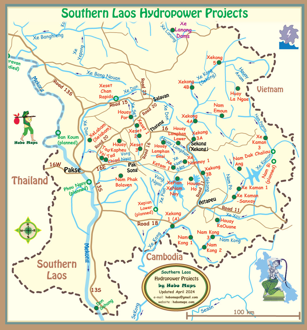
Tad Yoi & Tad Chiad hydropower projects located at mid-left of Southern Laos map below between Pakse and Pak Song:
The Vang Ngao River originates in Attapeu Province near the XePian-XeNamnoy hydropower project and flows westward into Champassak Province where Tad Chiad hydropower project is located. The Vang Ngao river was unfortunately affected by the Saddle Dam D rupture and flooding in 2018 at the XePian-XeNamnoy hydropower project. The Vang Ngao flows northwest from the Tad Chiad power plant eventually joining the XeKong river north of Pakse.