Tad Chiad Dam Hydropower Info by Hobo Maps - Go to Hydropower Projects Page --- Home
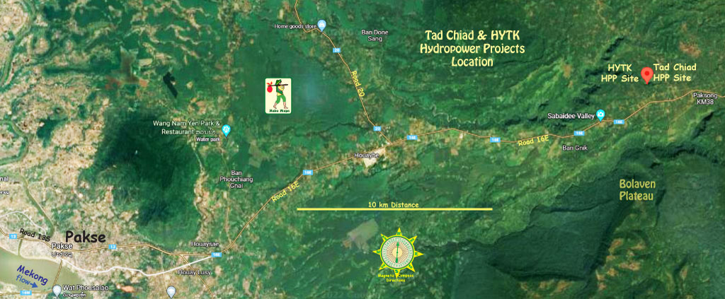
Tad Chiad Hydropower Project is located near Houay Chiad village, Paksong District of Champasak Province in southern Lao PDR about 14 km northeast of Pakse town.
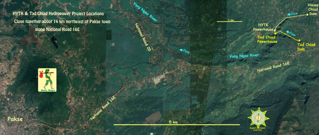
The project has a diversion dam on the Vang Ngao river a little north of National Road 16E at coordinates - 15°11'40.9"N 106°05'51.7"E (15.194694, 106.097685). The power plant is located at coordinates - 15°12'09.0"N 106°04'34.8"E (15.202496, 106.076336) about 1 km from the dam as seen in the images below.
Closer view of power plant site in image below.

Closer view of project layout in image below. From the satellite view we are assuming there must be an underground conduit carrying water from the dam reservoir to the surge tower we see above the powerhouse and penstock but we haven't seen a report of this and the dashed line in the image below is just our guess.

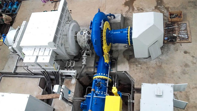
The project has 10 MW installed capacity from two horizontal Francis turbine/generator sets of 5 MW each.
Rated head for the project is 245 meters.
The project was commissioned and synchronized to the Lao grid on June 02, 2018.
Tad Chiad Dam images below at coordinates - 15°11'40.9"N 106°05'51.7"E (15.194694, 106.097685)


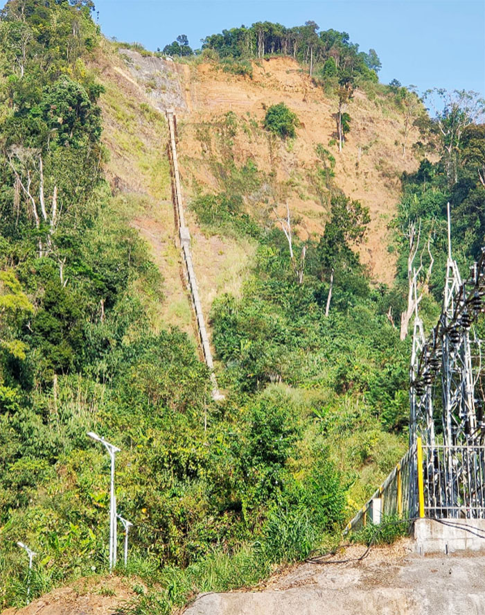
Tad Chiad penstock images below:


Tad Chiad view image below shows sharp dropoff of terrain. Not sure of the waterfall is for Tad Chiad project or more likely for nearby Houay Yoi:

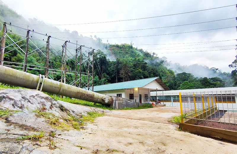
Tad Chiad powerhouse images below:


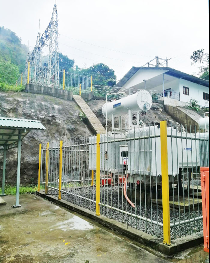
Power plant images below:


Tad Chiad generator label below in Chinese.

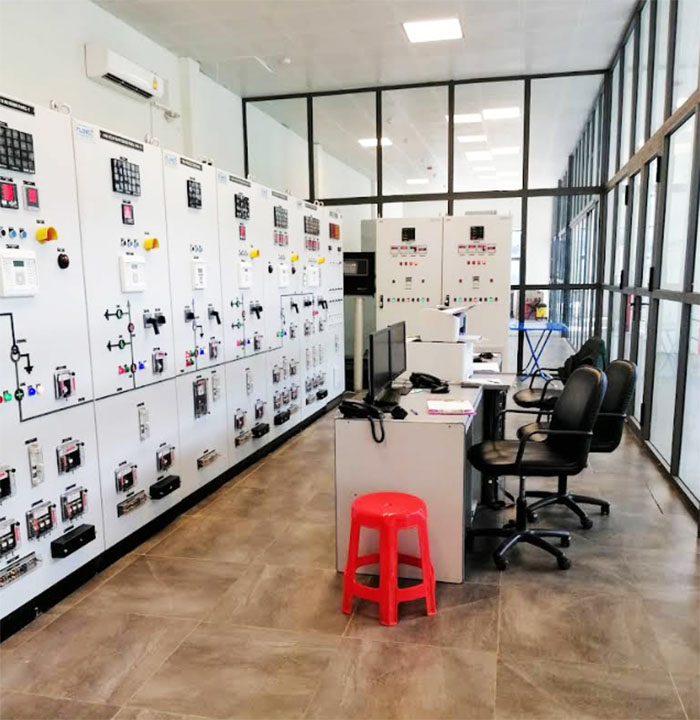
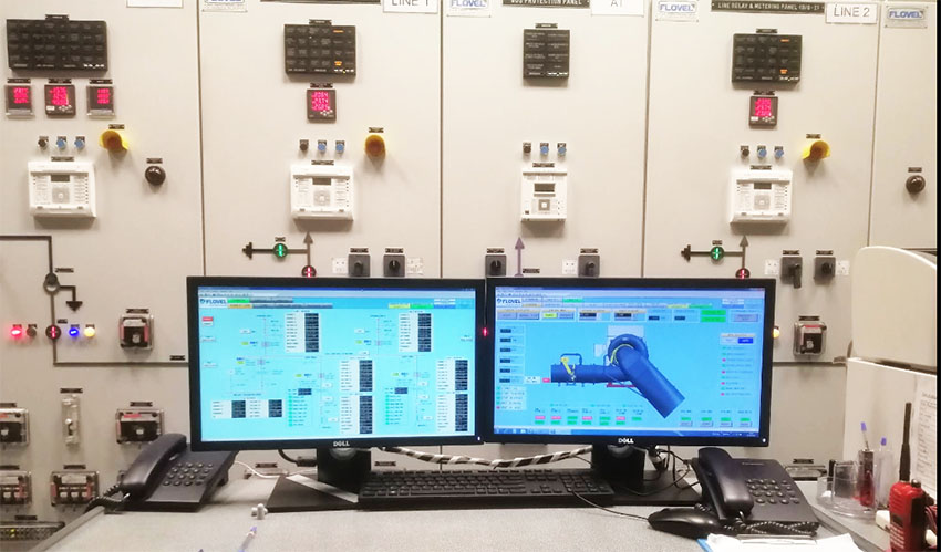
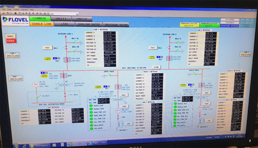
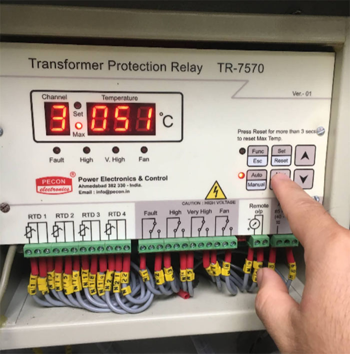
Tad Chiad controls images below:


Tad Chiad apparatus below:
Tad Chiad surge tower image below:


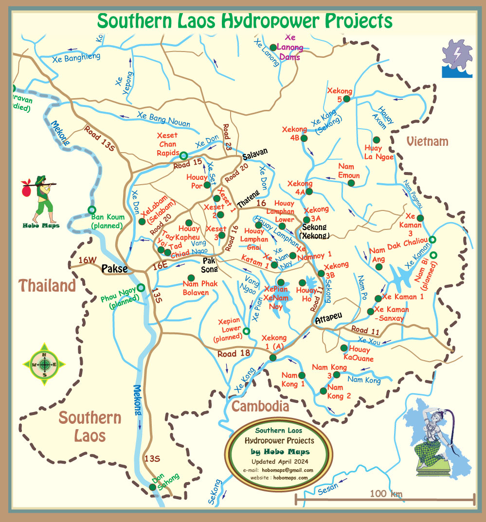
Tad Chiad hydropower project located at mid-left of Southern Laos map below between Pakse and Pak Song:
The Vang Ngao River originates in Attapeu Province near the XePian-XeNamnoy hydropower project and flows westward into Champassak Province where Tad Chiad hydropower project is located. The Vang Ngao was unfortunately affected by the Saddle Dam D rupture and flooding in 2018 at the XePian-XeNamnoy hydropower project. The Vang Ngao flows northwest from the Tad Chiad power plant eventually joining the XeKong river north of Pakse.
There is another hydropower project under construction nearby to Tad Chiad hydropower project called HYTK or Houay Yoi Tad Khod HPP. The satellite image below shows this project along with portions of the Tad Chiad project in the same area. See our separate web page for HYTK - HouayYoi Tad Khod Hydropower Project .
The Houay Chiad powerhouse coordinates are 15°12'15.6"N 106°04'32.9"E (15.204333, 106.075806) in satellite image below.

The powerhouse for the HYTK project is only 200 meters north of the Tad Chiad powerhouse and both seem to discharge their tailrace water into the Vang Ngao river.