
Nam Thea Dam Hydropower Info - by Hobo Maps - Go to Hydropower Projects Page - - Home
Nam Thea (also spelled Nam The or Nam Thae) Dam hydropower project is located near Ban Nam Thea in Kham District, Xieng Khouang Province, northern Lao PDR.
Image below shows a view of the project from the upper penstock looking northeast. Muang Kham town may be seen in the far background at the top of the image.
The project location is shown in satellite image below but the underground conduit has not yet been verified.

The project began construction in August 2019, was completed in early 2021 and is now operating and producing output.
The project has a water catchment area of 500 square kilometers and a small reservoir.
Lao-based Nong Hai Group is the investor and contractor for the project.
The project has a reinforced concrete dam with drainage gate.
There are 3 Francis horizontal turbines at 8.2 MW capacity each for 24.6 MW total with 119 GWh estimated annual output.
The powerhouse shown below is in Kham District at coordinates - 19°35'43.4"N 103°34'35.1"E (19.595381, 103.576411)

Nam Thea (The) Dam site is shown in the image below and located at - 19°33'21.9"N 103°32'22.9"E (19.556087, 103.539681)

Nam Thea (The) dam site is south of Muang Kham town and the junction of National Road 1C with Road 7.

Nam Thea dam & reservoir images below.


Nam The Dam powerhouse images below:


A YouTube video of the project power plant can be seen HERE .
A short Facebook video of the project area from above can be seen HERE .
Nam Thea turbine-generator images below:


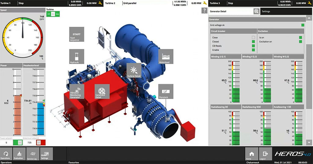
Nam Thea turbine-generator control display images below:

Nam Thea project construction images below:


Nam Thea project yard images below:

