Nam Tha Lan Dam Hydropower Info - by Hobo Maps - Go to Hydropower Projects Page - - Home
Nam Tha Lan is pronounced like "Nam Tah Lan".
Not much is known about the Nam Tha Lan (Talan) hydropower project other than its location and capacity of 5 MW with 21.9 GWh estimated annual output. The plant seems to have started full operation in 2021. We have no info about the owner of the project or who offtakes the output.
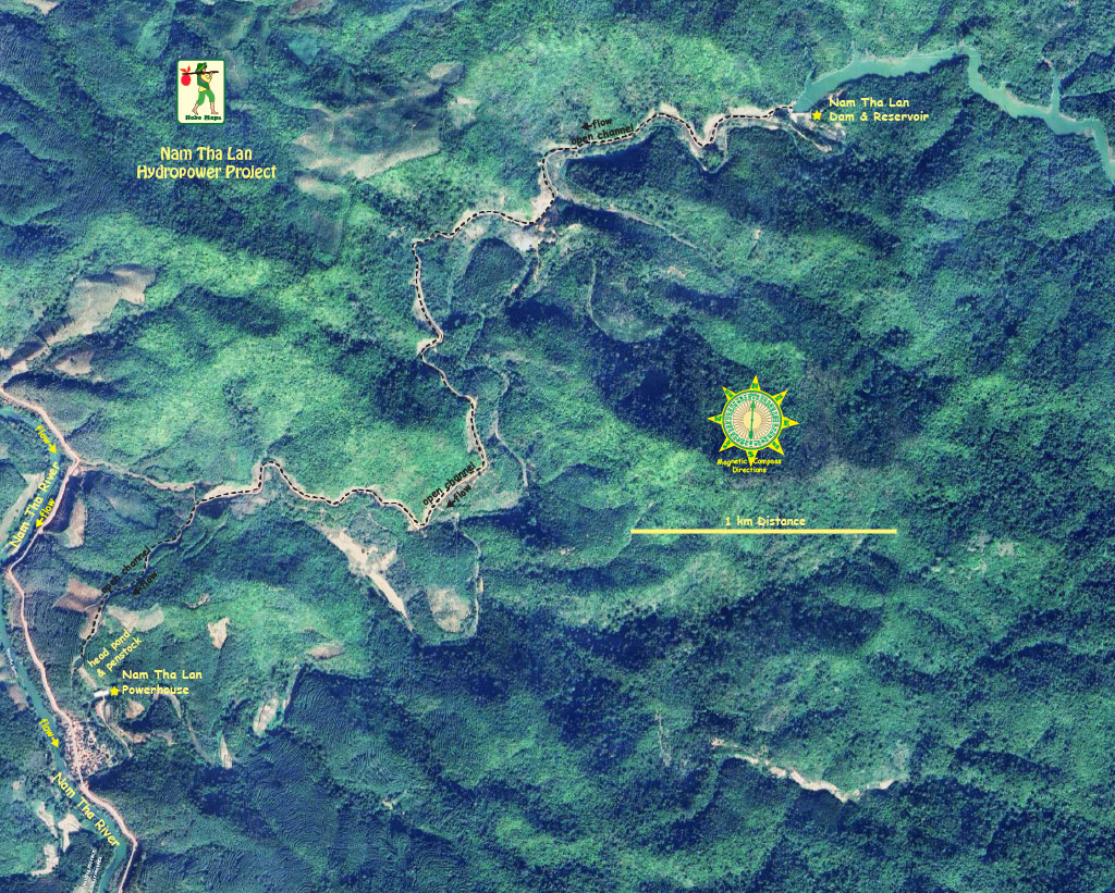
The project is located about 25 km southeast of Luang Namtha town in Luang Namtha Province of northern Lao PDR as seen in the satellite image below.

The project is on a tributary (unsure of name) of the Nam Tha river with the dam & reservoir about 4 km upstream from the power plant which is close to the Nam Tha river but not directly on it as seen below.

The Nam Tha Lan reservoir seems to be almost directly on the border between Luang Namtha and Oudomxay Provinces. The dam structure is located at coordinates - 20°50'42.5"N 101°29'49.6"E (20.845139, 101.497111).

Water is taken from the reservoir intake structure down about 4 km to a head pond in an open channel as in the images below.


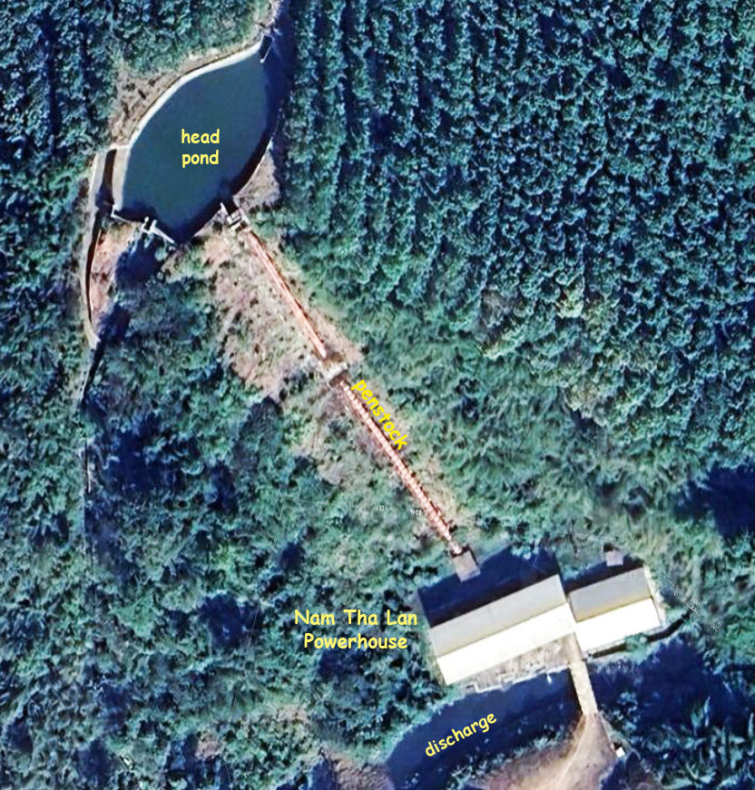
Nam Tha Lan power plant below has a short penstock of only 120 meters or so. Must be a steep drop.

The powerhouse is located at coordinates 20°49'27.0"N 101°28'10.0"E (20.824167, 101.469444).
