Nam Sam 1A Dam Hydropower Info by Hobo Maps - Go to Hydropower Projects Page - - Home
Nam Sam is pronounced "Nam Sahm" and Nam Sam 1A was also called "Nam Sum 1A" in the past and on some of the images below.
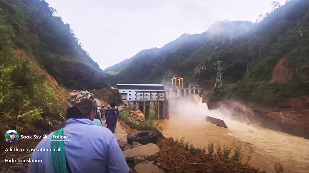
Image below (not verified yet) seems to show water release October 6, 2025 after heavy rains - from Facebook posting at https://www.facebook.com/reel/1305318641371065 .
The project is located in Samtai District, Houaphan Province of northern Lao PDR. It is southeast of Vieng Xay and Sam Neua towns - next to the Vietnam border and south of National Road 6.
Nam Sam 1A Dam Hydropower project dam site is located on the Nam Sam (river) known in Vietnam as the Song Chu river. The project is under construction as shown in the images below at coordinates 19°54'56.5"N 104°50'17.8"E (19.915694, 104.838278).

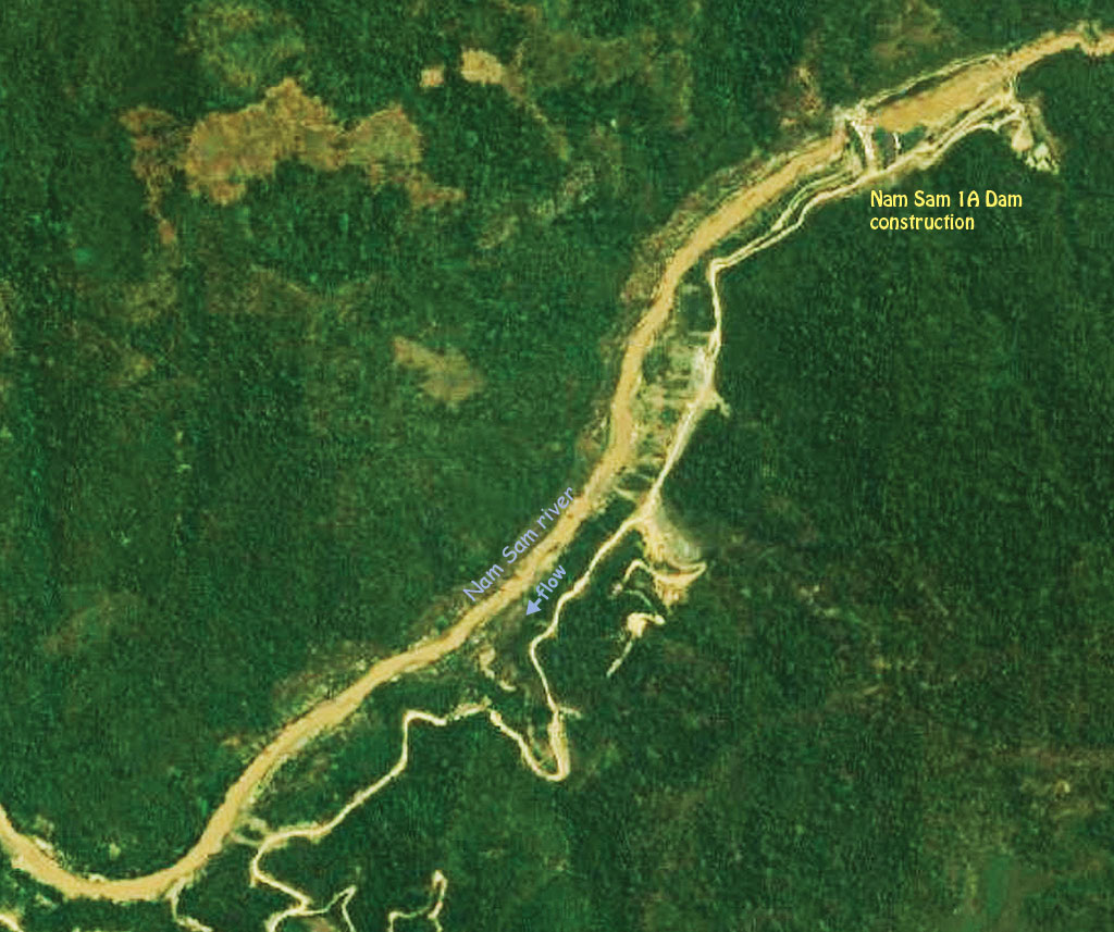
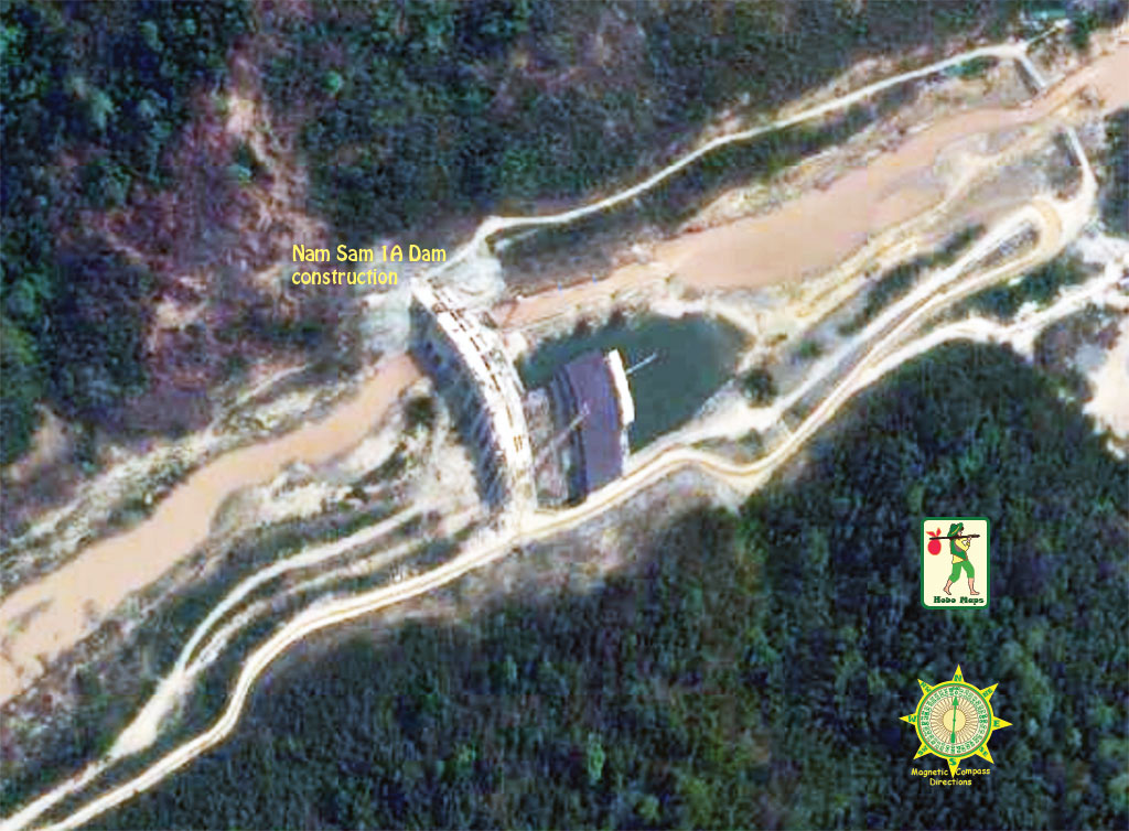
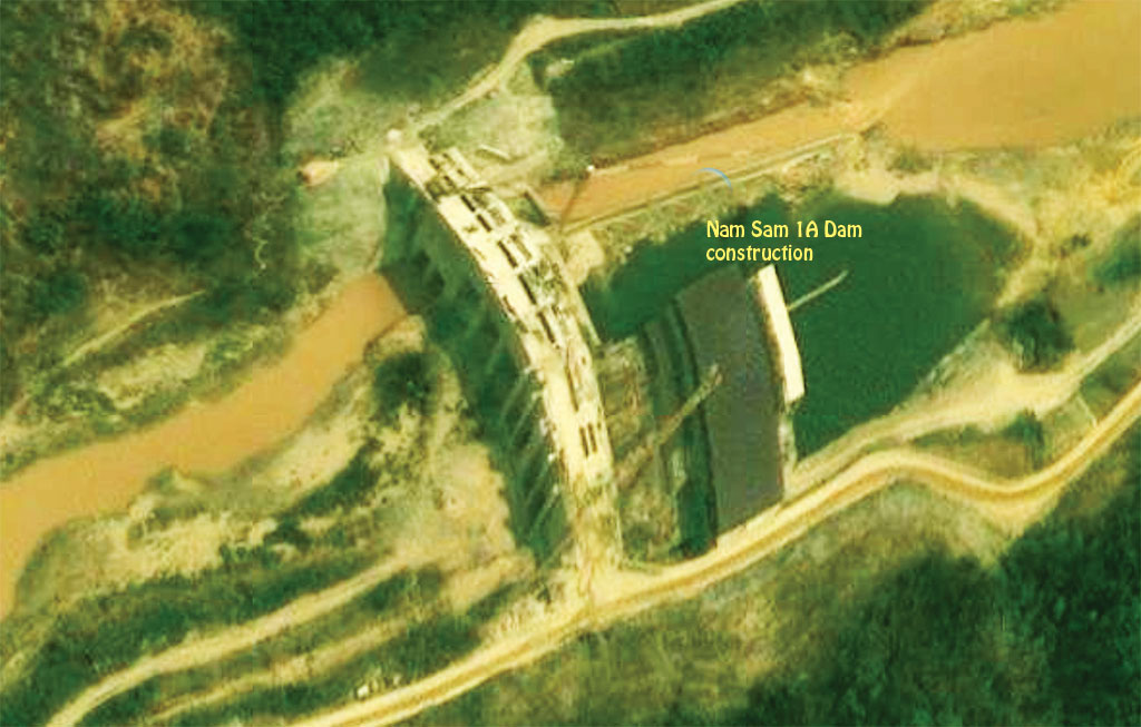
Dam site location on satellite images below:


There is very little information about this project on the web and much of the info below is from an old single source that needs to be verified and updated.
The project is under construction in 2024 and will become operational soon. In September 2024 we see job recruiting ads for workers to begin soon. In November 2024 we have one report of the project being finished along with Nam Sam 3.
Nam Sam 1A Dam is a 50 MW hydropower project with 2 vertical axis Caplan turbines at 25 MW each.
The gravity concrete dam is to be 129 meters long, 16.5 meters wide and 44.5 meters high.
The crest elevation of the dam structure is to be at 292 meters above sea level.
The normal surface water level of the reservoir is to be 272 meters above sea level.
The reservoir would have 41 million cubic meter capacity .
The project is developed by Phongsupthavy Group and invested by NamSum 1A Power Company Limited (a member unit of Trung Son Power Joint Stock Company) .
Hydro-mechanical equipment is provided by Quang Trung Mechanical One Member Company Limited.
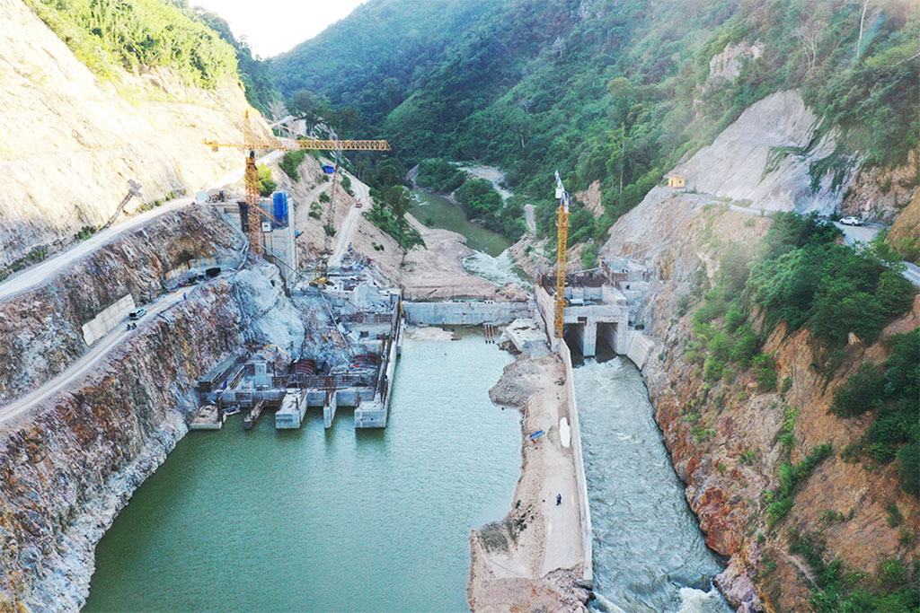
Nam Sam 1A site images below at the start of construction:


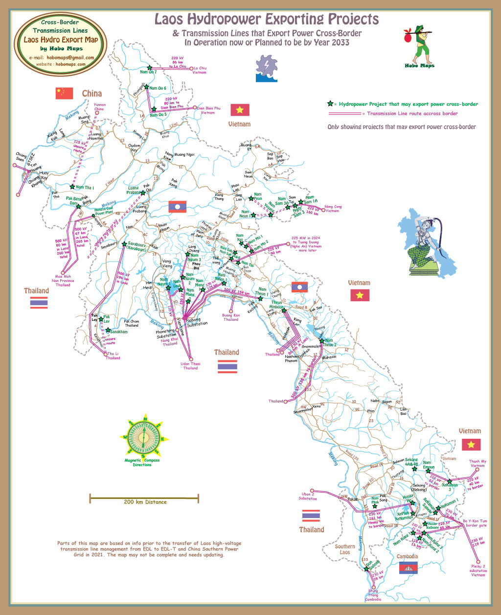
The project will be connected to Vietnam's electricity system transmission grid at the 220 kV Nong Cong Station (near Thanh Hoa Province, Vietnam).
On Nov. 13, 2020 the project signed a Power Purchase Agreement (PPA) with Vietnam (EVN) for sale and export of the project's output.
On December 21, 2024, the Vietnamese National Power Transmission Corporation announced the successful completion and energizing of the 220 kV Nam Sam-Nong Cong transmission line project. This project was initially scheduled for completion in 2022 for export of power to Vietnam from the Nam Sam area hydropower cluster which may include Nam Sam 1A, Nam Sam 3, Nam Sam 3A, Nam Neun 1 & 3, Nam Peun & the 6 dams of the Nam Yeuang cascade.
![]()
Nam Sam 1A connects to transmission line for export to Vietnam in map below at upper right side. See enlarged version HERE.
Project concept images below show what the Nam Sam 1 dam structures may look like:

