Nam Pot Dam Hydropower Info - by Hobo Maps -![]() Go Back to Hydropower Projects Web Page
Go Back to Hydropower Projects Web Page
The Nam Pot Hydropower project is under construction on the Nam Pot river in Xieng Khouang Province south of the Plain of Jars in Northern Lao PDR.
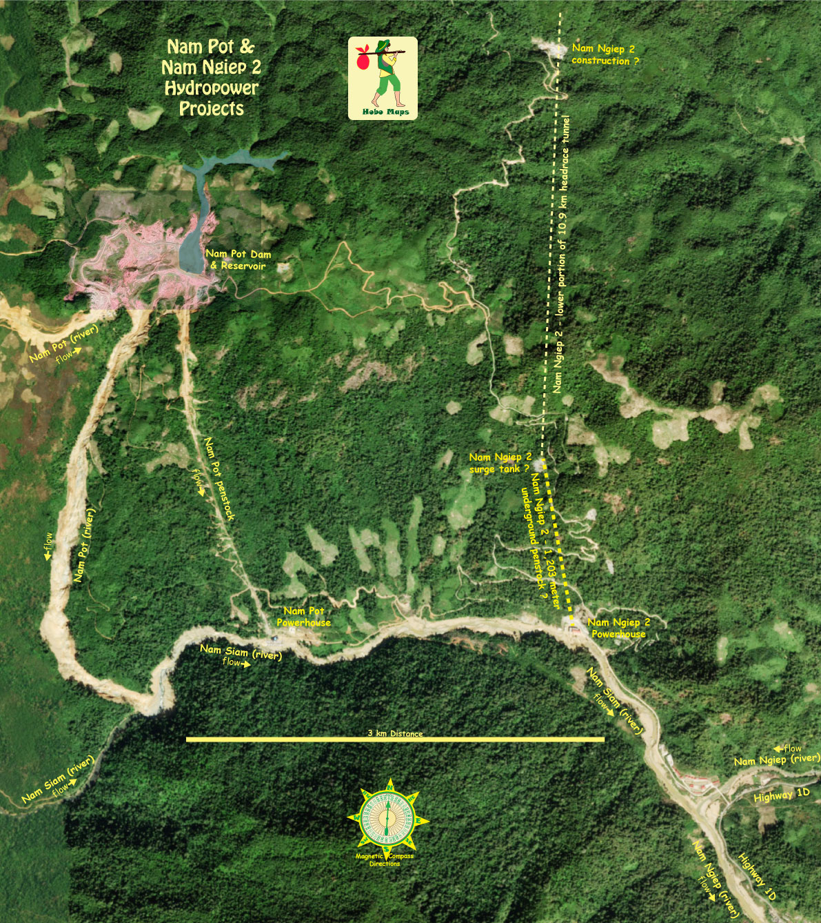
Nam Pot (river) is a tributary of the Nam Siam (river) that merges into the Nam Ngiep (river) which eventually flows into the Mekong near Paksan, Lao PDR.
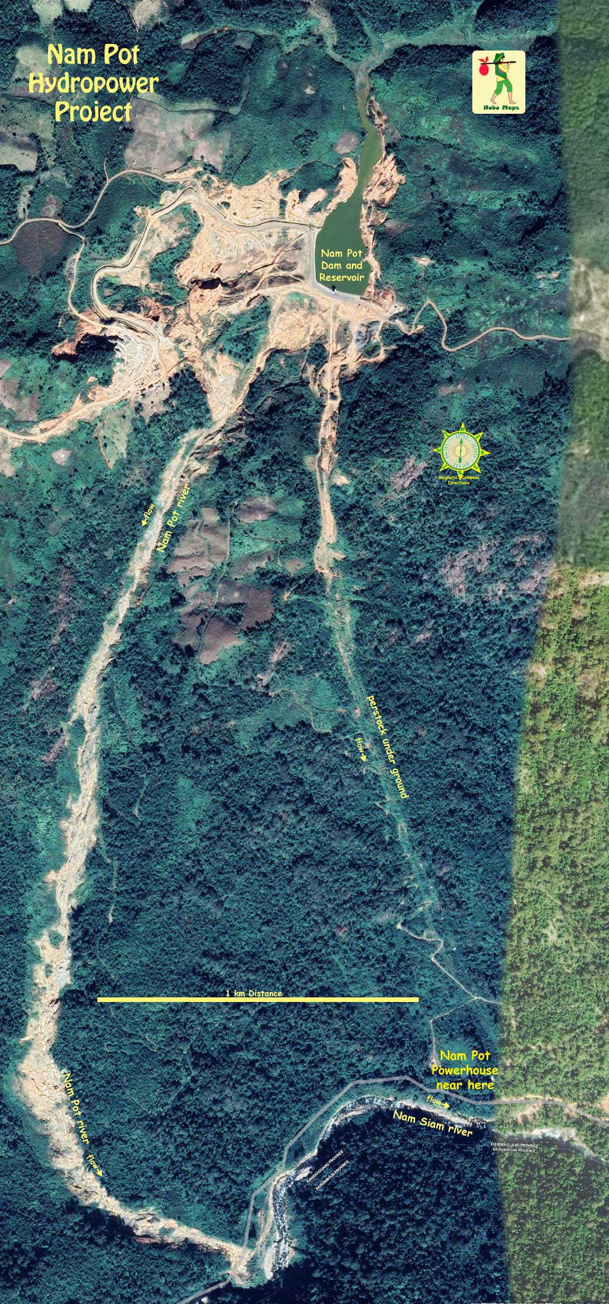
The dam structure is located 3.5 km upstream and north of the confluence of the Nam Pot river with the Nam Siam river. Downstream of the dam and reservoir, the Nam Pot falls 700 meters in elevation over a length of 3.5 km. Upstream of the dam the Nam Pot river flows in a shallow wide-bottomed channel. The area inundated by the reservoir is small and confined in a narrow valley.
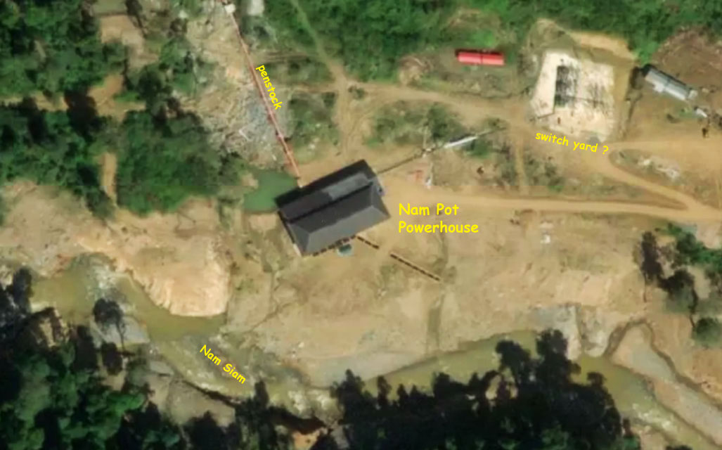
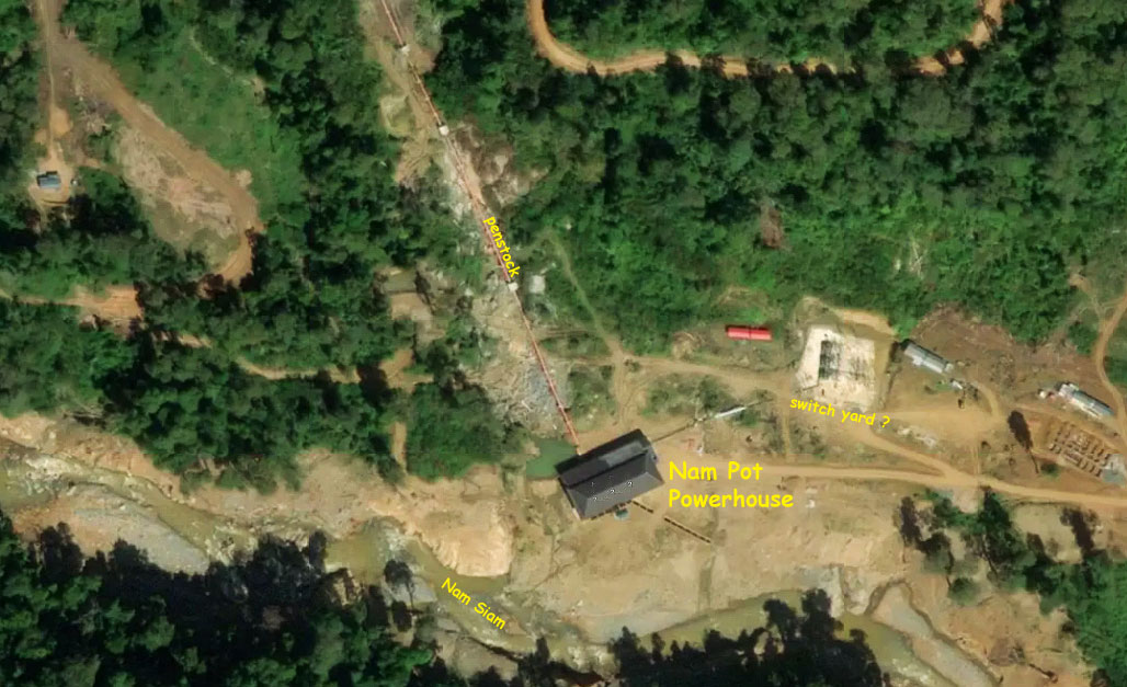
The power station site is on the left bank of the Nam Siam near its confluence with the Nam Pot.
This project is small capacity of 15 MW output with about 700 meters head.
The dam structure and reservoir location is 3.5 kilometers north of the proposed powerhouse location.
Reservoir surface full supply level is at 1,140 meters above sea level while minimum operating level is at 1,127 meters above sea level.
Very little public information is available about this project on the internet and we don't know at this time who the owners and developer are. An old outdated source lists ACE Consultant as being involved in early development of the project.
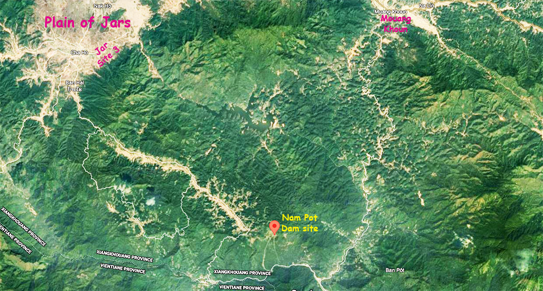
Nam Pot Dam and Reservoir location coordinates - 19°09'39.0"N 103°17'01.0"E (19.160833, 103.283611) - as shown on satellite image below:
Nam Pot powerhouse location coordinates - 19°08'15.0"N 103°17'17.0"E (19.137500, 103.288056) - on satellite image below:
Nam Pot Hyropower project details below from very old 2004 preliminary study document. Some may have been revised in actual implementation.
Reservoir: Full supply level (FSL) 1,140 meters above sea level
Minimum operating level (MOL) 1,127 meters above sea level
Max storage volume (FSL) 52.08 million cubic meters
Active storage volume 44.07 million cubic meters
Maximum reservoir area (FSL) 4.9 square km
Reservoir filling time 7.5 months
Main dam type RCC Gravity
Maximum height 26 meters
Crest length 130 meters
Number of turbine units 2
Turbine type Pelton
Turbine rated head 673 meters
Transmission: Line Length 6 km
Voltage 115 kV
Output: Installed Capacity 15 or 20 MW
Guaranteed capacity (95%) 19.4 MW
Average generation 92 GWh p.a.
Primary generation (95% firm) 65 or 89 GWh per annum
Secondary generation 3 GWh per annum
Average plant factor 53 %
Basic project cost (no esc. or IDC) 23.93 million US$
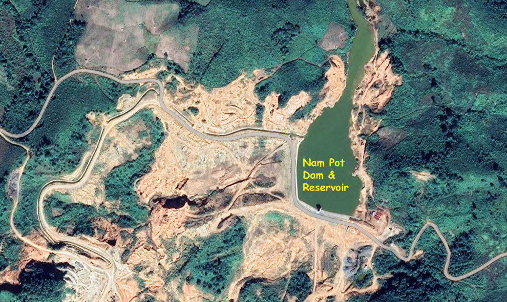
Nam Pot Dam & Reservoir satellite image below:
Nam Pot powerhouse site satellite images below:
Nam Pot & Nam Ngiep 2 area map below shows both powerhouses only 2 km distance apart on the Nam Siam river:
Plain of Jars Map below shows road going south to Nam Pot Hydropower project at bottom left corner:
