Nam Phay (Phai) Dam Hydropower info by Hobo Maps - Go to Hydropower Projects Page - - Home
Nam Phay Hydropower Project is also spelled Nam Phai. Nam Phay is pronounced like "Nam Pie".
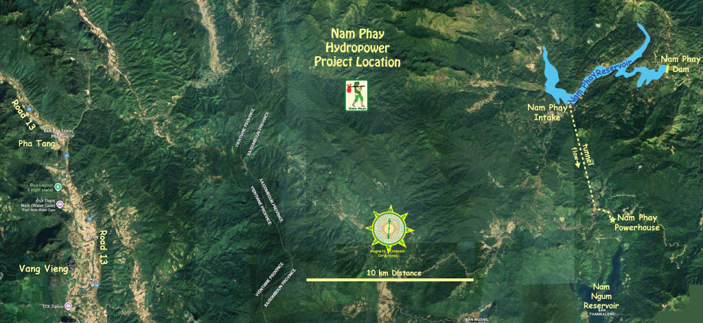
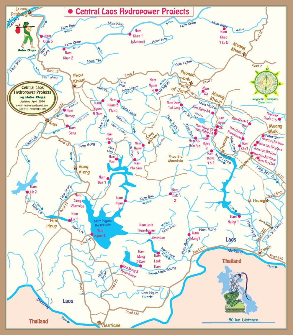
The project is located in Longchieng (Longtieng) district of Xaysomboun Province, Lao PDR. The dam site is located in a valley upstream from the Nam Phay (river), a tributary of the Nam Ngum (river) which is a tributary of the Mekong River.
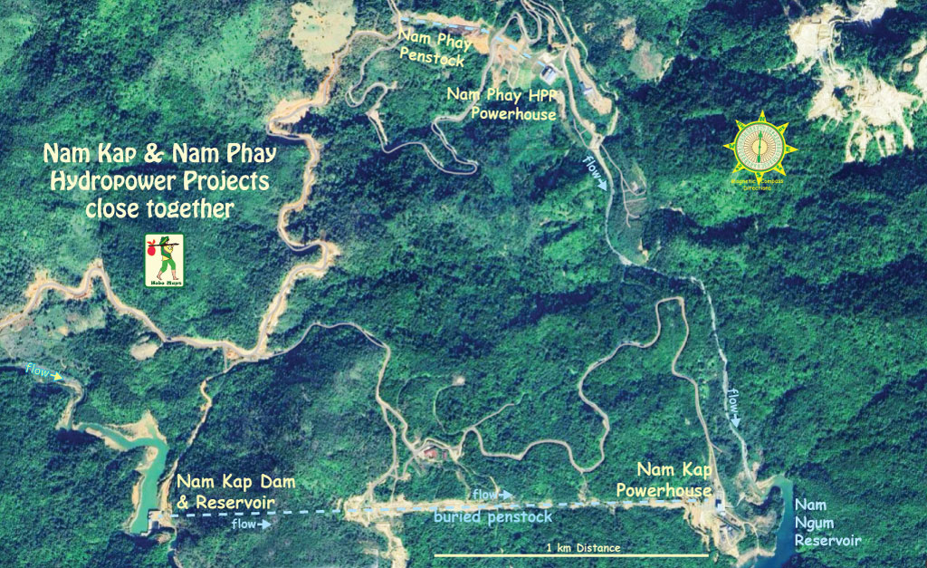
The powerhouse is located on the right bank of the Nam Leuk (Louk) river.
Nam Phay reservoir is located at coordinates 19°06'43.9"N 102°46'42.1"E (19.112194, 102.778361).
On 25 November 2013, Nam Phay Power Company Ltd. (NPPC) was established as a joint venture between Hong Kong Frame Star Development Ltd. (85% ownership) and Electricite du Laos (15% ownership) to finance, develop and operate the 86 MW Nam Phay Hydroelectric Power Plant. Later reports have China-based Norinco International Cooperation Ltd. (Norinco) as owner of Hong Kong Frame Star Development Ltd.'s 85% share of the project
On 28 February 2014 and 4 March 2014, Nam Phay Power Company Ltd. and the Government of Laos signed franchise and concession agreements for the Project. The total estimated cost of the project was $218 million which was to be financed with a mix of debt and equity with China Exim Bank issuing a $148 million loan with a 15 year maturity and a 3 year grace period.
On 23 June 2015, China Eximbank and NPPC signed a loan agreement for the Project.
The project started construction in 2013 or 2014 and commercial operation began in Nov. 2017 under a 25 year concession agreement with government of Lao PDR.
Nam Phay (Phai) Dam images below at coordinates - 19°06'43.9"N 102°46'42.1"E (19.112194, 102.778361)

The project is a medium-scale inter-basin diversion project.
Nam Phay Power Company Ltd. (NPPC) was responsible for construction and is operating the project.
The project EPC contractor was PowerChina Resources Ltd, a branch of Power Construction Corporation of China.
Nam Phay Powerhouse images below at coordinates 19°02'00.0"N 102°44'39.4"E (19.033333, 102.744280):


The Nam Phay Hydropower Project has a 720 meter head. It includes a concrete-face rock-filled dam that impounds Nam Phay (river) creating a reservoir with a surface area of 8.92 square km.
The powerhouse is located on the right bank of Nam Louk (river). The penstock length is 1,507 meters.
Chongqing Water Turbine Works provided 2 electric generators and 2 pelton turbines at 43 MW capacity each for 86 MW total capacity with annual power output potential of 397 GWh.
Power generated from the project is to be sold to Electricite du Laos under a power purchase agreement for distribution to Xaysomboun and Xieng Khouang provinces in Lao PDR through a 115-kV transmission line connected to Thongkhoun 2 substation.
Nam Phay hydropower project layout image below. The powerhouse is about 6.5 km south of the reservoir intake structure and we are assuming there must be an underground conduit connecting them although we haven't seen any info confirming this. The powerhouse has been confirmed as being on the right bank of the Nam Leuk (Louk) river south of the reservoir.

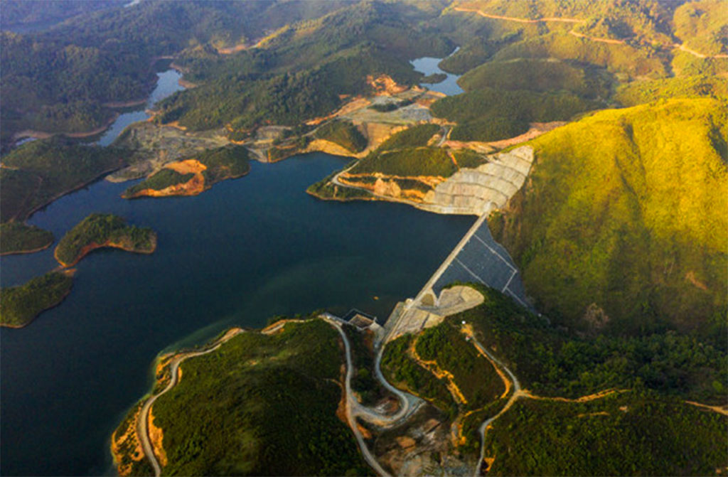
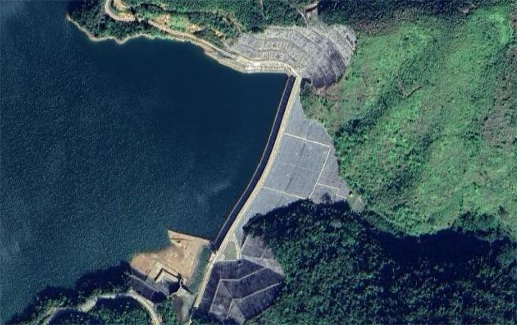
Nam Phay dam reservoir image below:
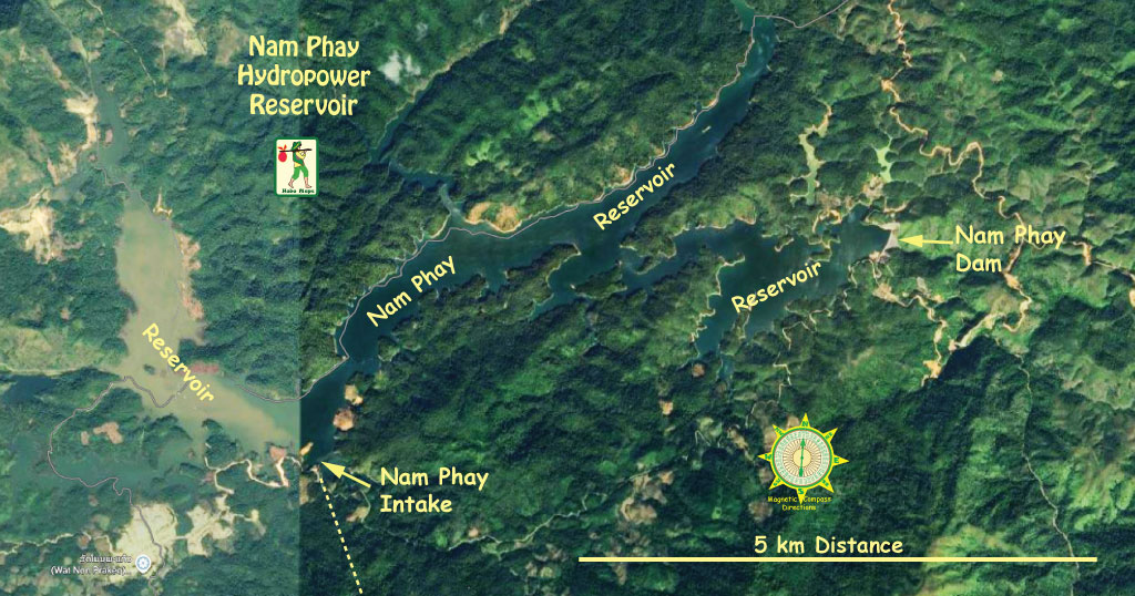
Nam Phay HPP reservoir images below:


Nam Phay dam intake area view below:

Nam Phay dam intake structure images below:


Nam Phay plant site satellite images below:

Nam Phay HPP Project History below:
In July 2011, an environmental impact assessment (EIA) was completed and on April 30, 2013, the Government of Laos approved the EIA.
On May 16, 2012, the project feasibility study report was approved.
In March 2014 Project construction was in progress.
On June 18, 2016 reservoir impoundment began.
On May 8, 2017, the plant's power generating units successfully passed 72 hour commissioning and came into full load operation
On June 20, 2017, the project passed a final inspection.
On November 1, 2017 the project achieved its commercial operation date (COD).
On December 1, 2017, the Director of Electricitie du Laos (EDL) signed the power plant's COD certificate.
On January 22, 2018, the power plant was officially inaugurated.
In December 2020, the Project passed inspection after 1,302 days of continuous operation.
Nam Kap & Nam Phay hydropower projects are close together as seen in satellite image below:
Nam Phay Reservoir and access Road 9308 image below:
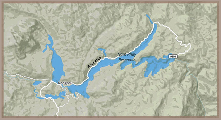
Nongpou resettlement village image below.

Nam Phay Dam community image below:

Nam Phay dam shown in central part of map below - the Powerhouse is below it on Nam Louk:
The Nam Phay hydropower project has qualified as a greenhouse-gas-reducing Clean Development Mechanism (CDM) project under the Kyoto Protocol and has a 7-year renewable crediting period. Estimated CO2 emission reductions during this crediting period are 222,121 tons per year.
Click HERE to view/download CDM application PDF file.