
Nam Phao Dam Hydropower Project Info by Hobo Maps - Go to Hydropower Projects Page - - Home
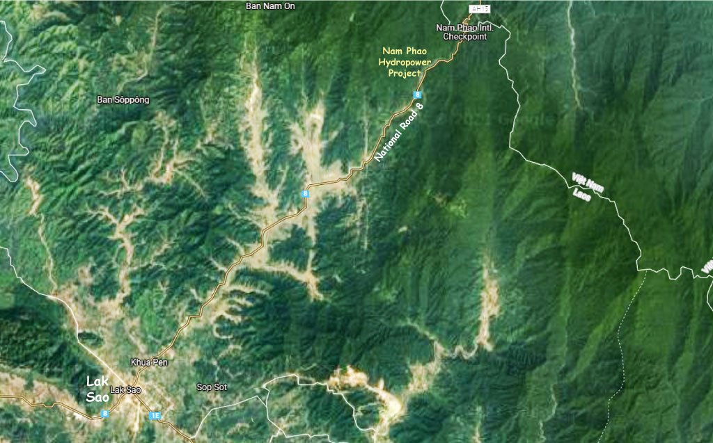
The Nam Phao Hydropower project is located on the Nam Phao (river) in Bolikhamxay Province, Lao PDR along National Road 8 about 10 km south of the Vietnam border checkpoint.
Nam Phao is pronounced like "Nam Paow".
Nam Phao Hydropower project location image below at coordinates - 18°21'45.4"N 105°08'06.7"E (18.362609, 105.135183):
The Nam Phao (river) originates on the Nakai Plateau and flows south next to Road 8 until it crosses National Road 1E east of Lak Sao town. It then flows eastward until it joins the Nam Kata (river) which joins the Nam Theun (river) that flows into the Nam Kading and eventually into the Mekong River near Pak Kading.
Nam Phao Hydropower plant location image below:
The project is a small plant of only 1.7 MW capacity and has been operating since 2011 providing power for Lao domestic consumption.
We aren't aware of who the owners and operators of the project are.
In 2026 we have seen unconfirmed reports that this hydropower project has ceased operations since the Truong Son wind power project in the same area has begun operations. But this seems not logical as the wind farm exports its power to Vietnam while Nam Phao output is for domestic consumption in Laos.
On satellite images we can see a small weir dam and pond west of National Road 8. From there we see a water channel taking a water flow down to a penstock and into a powerhouse building. The project is only about 5 km south of the Vietnam border checkpoint.
Nam Phao project operates with a head of 62.5 meters.
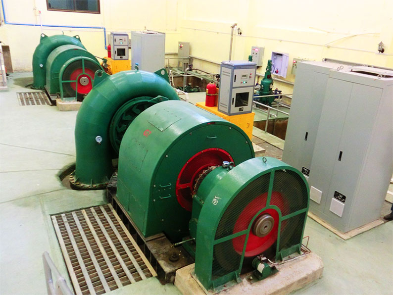
The project has two horizontal Francis turbine-generator sets at .85 MW each for total capacity of 1.7 MW
Nam Phao Hydropower project layout image below:

Nam Phao powerhouse image below:

Nam Phao hydropower project site image below:

Nam Phao hydropower penstock image below:

Nam Phao river and hydropower plant images below:


Nam Phao turbines & generators image below:
Nam Phao controls image below:

Nam Phao hydropower switchyard image below:

![]()
Nam Phao weir images below:


As of September 2025, the Nam Phao hydropower project has the 250 MW Truong Son wind power project operating in the same area with the wind power output being exported to Vietnam.