
Nam Nga 2 Dam Hydropower Info by Hobo Maps - Go to Hydropower Projects Page - - - HOME
Nam Nga 2 Dam and hydropower project is situated on the Nam Nga (river) in a rural location near Keow village, Nga district, Oudom Xay Province of northern Lao PDR.
The coordinates of the project powerhouse and dam structure are - 20°10'57.8"N 101°55'22.4"E (20.182708, 101.922885) as seen at red marker in satellite image below.
The project is developed by Nam Nga 2 Hydropower Co., Ltd.
Project contractors involved Heuang Paseuth Electricity Construction Enterprise Co., Nam Nga II Company and Kunming Survey and Design Institute of China Hydropower Engineering Consulting Group.
PowerChina Kunming was engineering, procurement and construction (EPC) contractor.
Nam Nga 2 plant images below:
Nam Nga 2 spillway and powerhouse discharge images below:

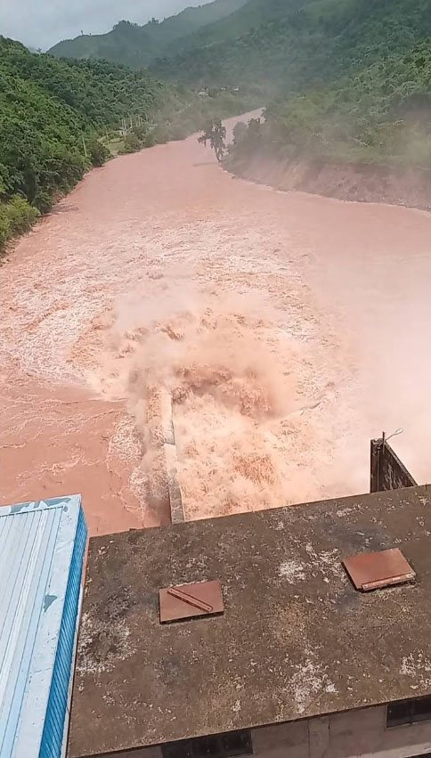
See Facebook video of dramatic flood release over spillway in August 2024 HERE
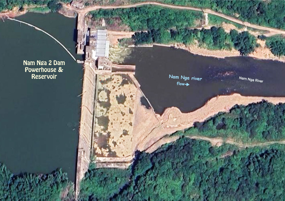
Nam Nga 2 Dam image below:

The project includes intake structure, headrace channel, head tank, penstock and powerhouse.
The installed capacity of the project is 14.5 MW (2 units of 7.25 MW each) with annual output capacity of 62.5 GWh.
The dam structure is 245 meters long and 47 meters high.
The project construction cost was estimated at more than US$ 30 million.
There were apparently no villages directly impacted by the dam and reservoir and no relocations of local people.
The small reservoir has about 9.3 million cubic meters storage capacity and covers an area of about 1 square kilometer.
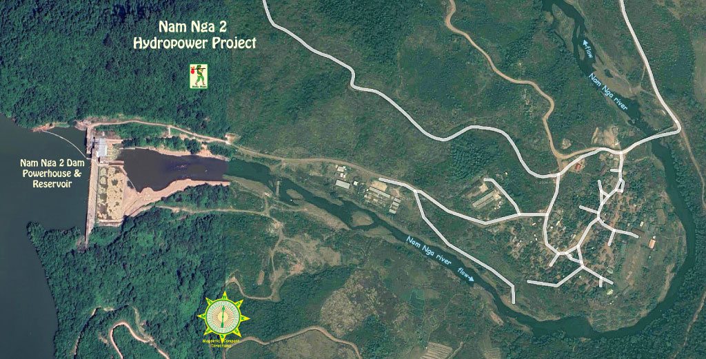
Satellite image showing the dam and hydropower station location is below:

Nam Nga 2 location map below shows access road:

Nam Nga 2 offices are in central Oudom Xay (Muang Xay) town as shown below and on THIS MAP .

Nam Nga 2 office in Oudom Xay image below:

The project qualified as a Clean Development Mechanism (CDM) project under the Kyoto Protocol and has an estimated annual average Greenhouse Gas emission reduction of 35,019 tons CO2. The Clean Development Mechanism is a mechanism that encourages and subsidizes greenhouse gas emissions-reduction projects. These projects can earn Certified Emission Reduction units which may be traded for value. View or download the CDM application PDF document HERE .