Nam Mang 3 Dam Hydropower info by Hobo Maps - Go to Hydropower Projects Page - - - HOME
The project is located in Thulakham District, Phou Khao Khouay area, Vientiane Province of Lao PDR not far off Highway 10 about 60 km north of Vientiane Capital.
The Nam Mang 3 Hydropower Project is a transbasin project that diverts water from the Phou Khao Khouay plateau down into the Nam Nyam and Houay Hong Pheng rivers. It has multiple dam structures and saddle dams.
Nam Mang is pronounced as "Nam Mong".
The project coordinates are 18°20'58.1"N 102°45'56.6"E (18.349483, 102.765713) as shown in the satellite image below.
Nam Mang 3 reservoir shown in topographic map below:

The Nam Mang 3 project is not on or near the Nam Mang river and we wonder why it has that name. The unrelated Nam Mang 1 project is on the Nam Mang river which is about 25 km east of the Nam Mang 3 project.
Nam Mang 3 Hydropower Station and downstream area shown below:

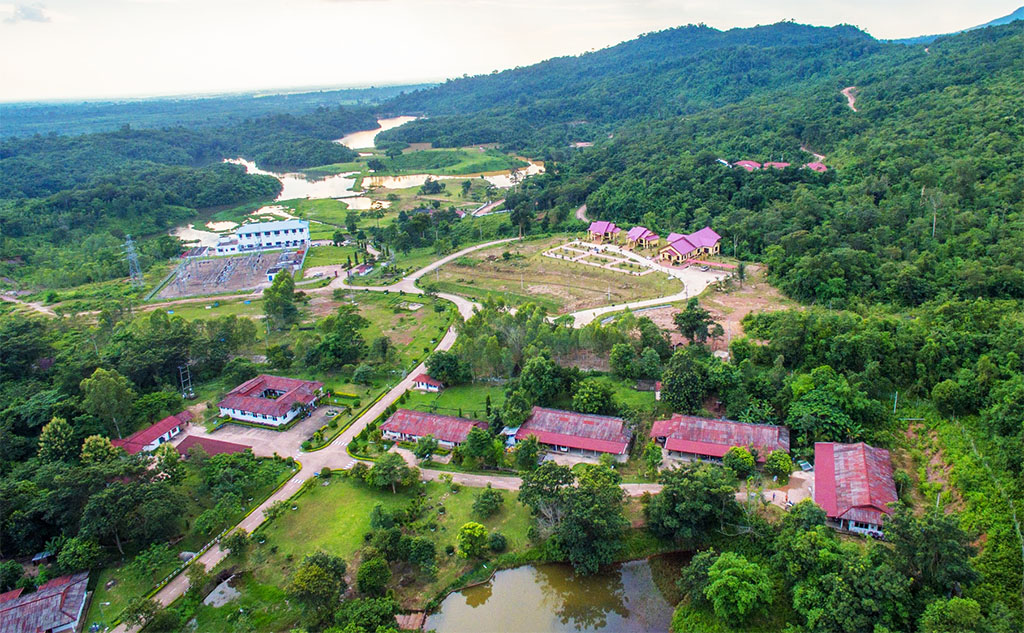
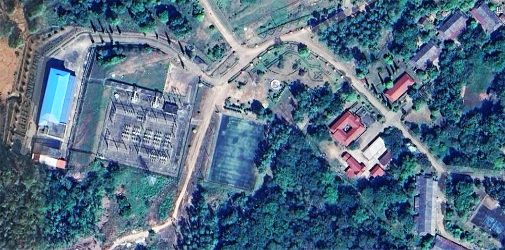
Nam Mang 3 Hydropower site area images below:

The owner and operator of the project is EDL Generation Public Co. Ltd. (EDL GEN). The project started construction in 2002 and commenced commercial operation on January 18, 2005. China International Water and Electric Corporation (CWE) was in charge of the project's construction.
Nam Mang 3 Hydropower Plant construction was divided into two phases. The total construction cost of the first phase was US$ 63 million and the second phase US$ 27 million. In both phases, 80 percent of the cost was financed by a loan from Export-Import Bank of China and the remaining 20 percent contributed by EDL.
Nam Mang 3 main dam and spillway shown below at coordinates - 18°21'17.8"N 102°48'12.4"E (18.354944, 102.803444):


Nam Mang 3 saddle dams images below - one of the saddle dams is earthfill type 19 meters high.


Water from the Nam Gnong (Yong) river at 750 meters above sea level is channeled down to the power plant at 200 meters above sea level taking advantage of 550 meters head.
Nam Mang 3 project satellite images below:


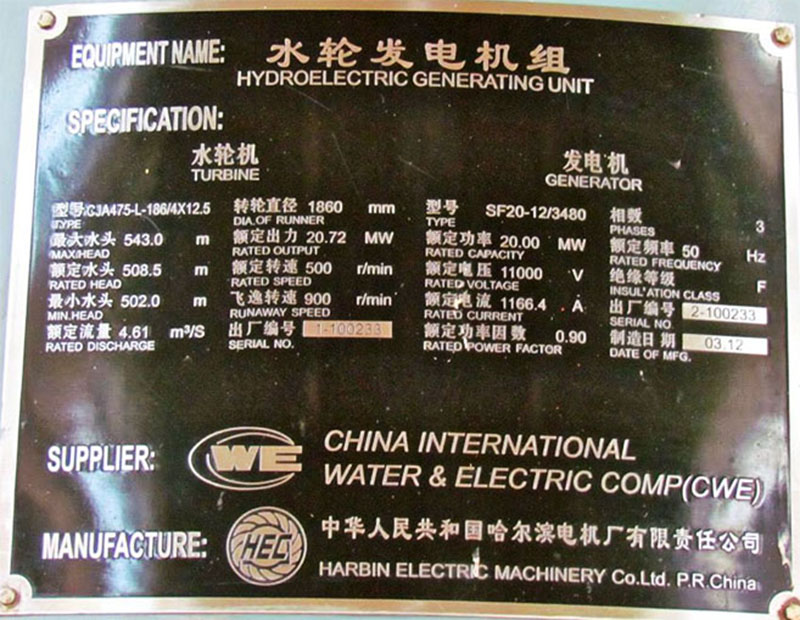
The powerhouse contains two vertical Pelton turbine-generator sets rated at 20 MW each for 40 MW installed capacity with ability to generate 187 GWh output per year.
The powerhouse is planned to operate on a peak-load basis between 12 to 24 hours a day during the wet season and 6 hours a day during the dry season in order to guarantee a minimum 6 GWh of energy production every month of the year. About one third of the electricity generated was planned for export to Thailand with the rest to be utilized in Lao PDR.
Nam Mang 3 project aerial view video
Nam Mang 3 EDL GEN promotional video
Nam Mang 3 layout below:

Powerhouse location is at coordinates - 18°19'53.6"N 102°44'10.2"E (18.331556, 102.736167).

Trans-basin aspect of Nam Mang 3 Hydropower Project shown below:

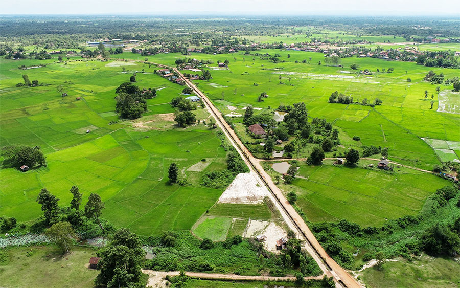
The water discharged downstream of the powerhouse is channeled into a regulating pond to be gradually released to the nearby Nam Ngam river and into the Nam Nyam valley for irrigation purposes. About 2,900 hectares of land can be irrigated.
The catchment area for the project is only 68 square km.
The Nam Mang 3 project has a 10.2 square km reservoir on the Nam Nyang river. Storage capacity is 58 million cubic meters at Full Supply Level 750 meters above sea level. Active storage is 44.5 million cubic meters at minimum supply level 742 meters above sea level.
The main dam is Roller Compacted Concrete (RCC) type 28 meters high, 150 meters wide and 150 meters long (crest length).
The intake structure is located in the reservoir near the saddle dam.
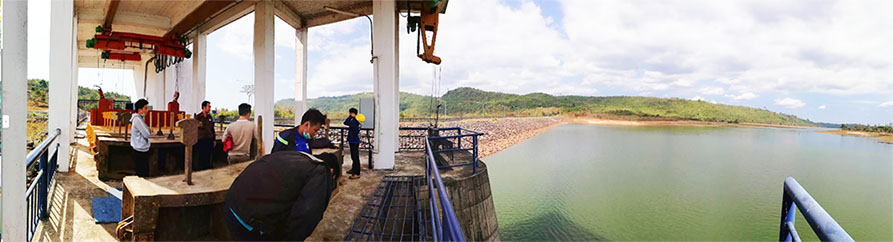
Nam Mang 3 reservoir and area images below:


Nam Mang 3 irrigation channel image below.
The tunnel from the intake to the surge tank is 512 meters long with diameters between 1.8 meters and 2.2 meters.
The penstock has a vertical drop of 544 meters and is 3,152 meters long with diameters of .9 meter and 1.8 meters.
The surge tank located between the tunnel and penstock is 41.3 meters high with diameter of 4.5 meters.

Nam Mang 3 site and switchyard image below:

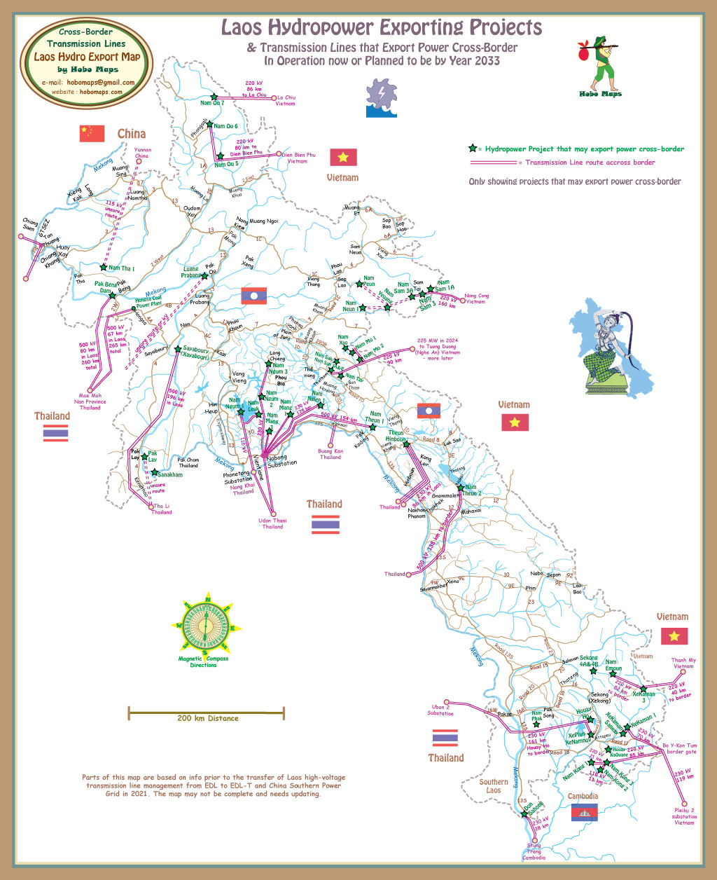
The transmission line is 115 kv double circuit that runs about 30 km to Nabong substation.
![]()
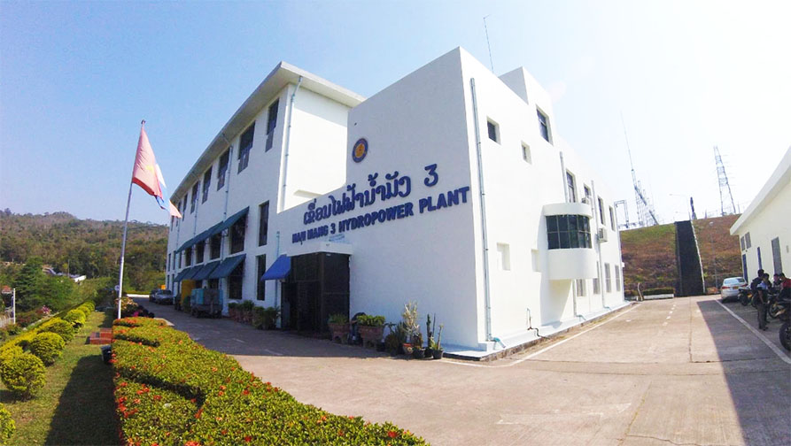
Nam Mang 3 plant facility images below:

Nam Mang 3 powerhouse interior images below:


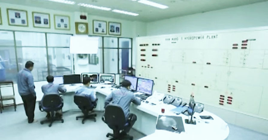
Nam Mang 3 control images below:


Nam Mang 3 generator plate image below:
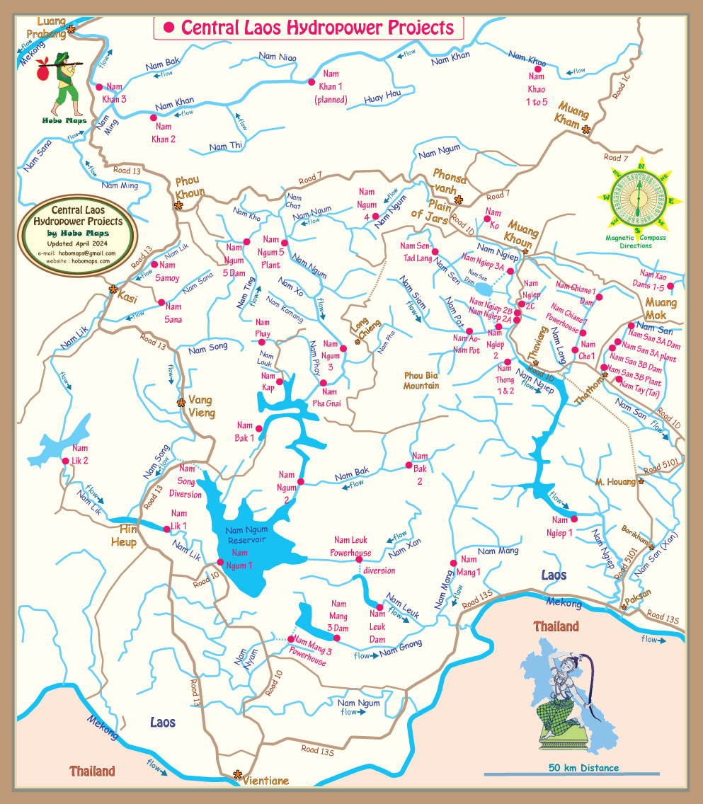
Nam Mang 3 location shown in lower part of map below:
Nam Mang 3 location and diversion shown at bottom of basin map below:


Nam Mang 3 Resort image below:

Nam Mang 3 hydropower is able to export some of its output to Thailand via the Nabong Substation as seen in the Export Map below. See enlarged version HERE.