
Nam Lik 1 Dam Hydropower info by Hobo Maps - Go to Hydropower Projects Page - - - HOME
This web page below is for Nam Lik 1, see our other web page for Nam Lik 1-2 (Nam Lik 2)
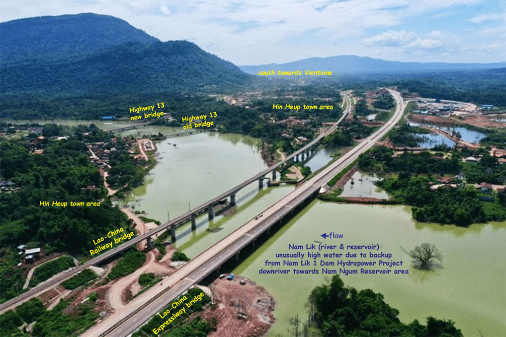
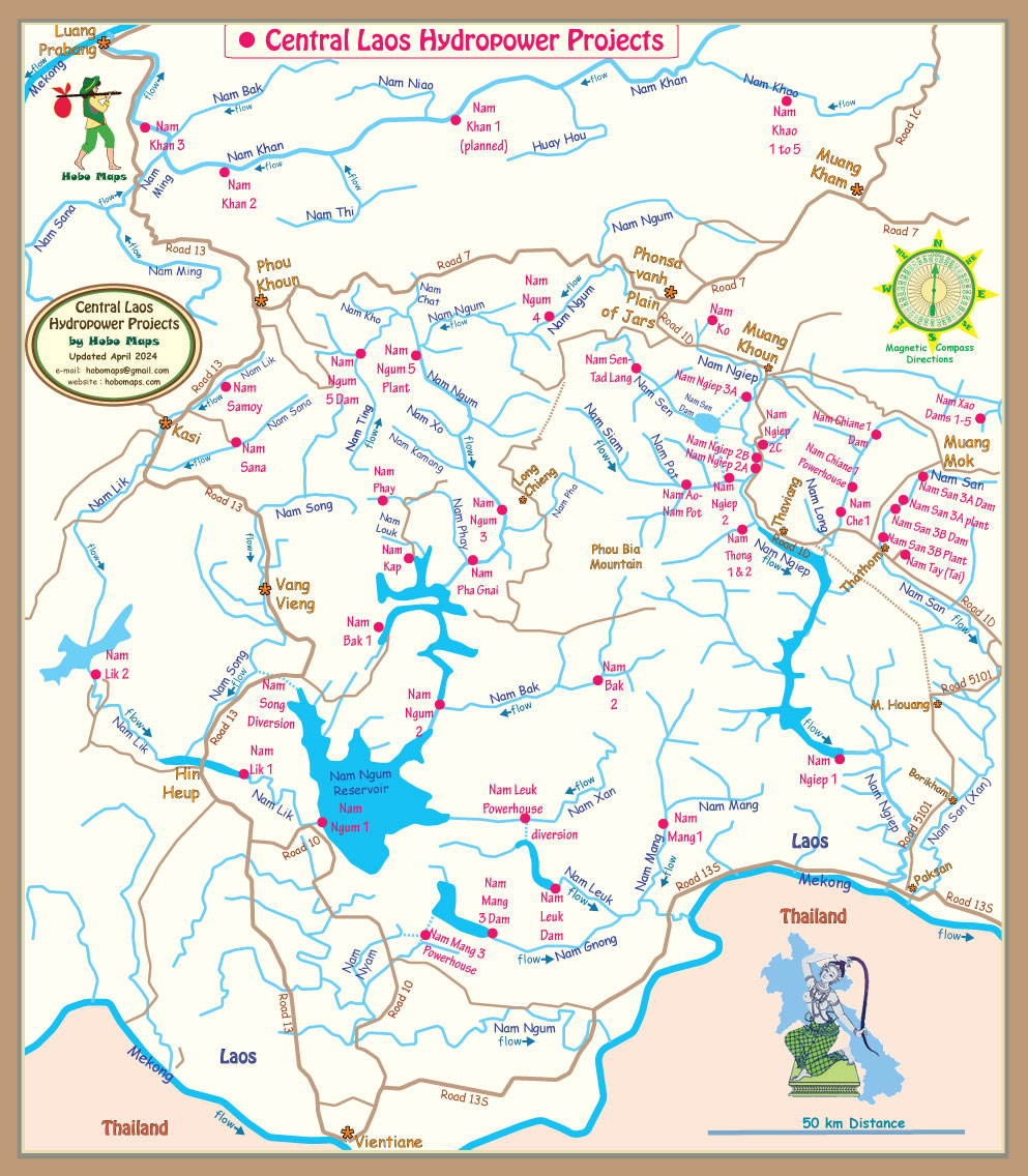
Nam Lik 1 Hydropower project is located on the Nam Lik river about 90 km north of Vientiane Capital in Hinheup district, Vientiane Province, downstream from the Nam Lik 1-2 dam and 9.6 km downstream of the Hin Heup Bridges on National Road 13. The Nam Lik river runs through Hinheup district before merging into the Nam Song river near Nam Ngum reservoir.
Nam Lik is pronounced like "Nam Leak".
Nam Lik 1 project location seen below at coordinates 18°37'04.8"N 102°23'13.2"E (18.618, 102.387):

The Nam Lik 1 hydropower project is developed by Nam Lik 1 Power Company Ltd, - initial shareholders were Global Power Synergy Public (an affiliate of PTT Global Chemical Public Company Limited) 40%, Hydro Engineering Company Ltd. 10%, POSCO Engineering and Construction Company Ltd. 10% and EDL-Generation Public 40%. Seems that EDL GEN's share is later at 10%
Construction commenced in 2014 and the project entered into commercial operation in 2019. Estimated cost was US $124 million.
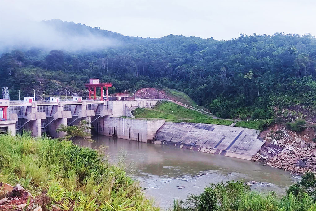
Nam Lik 1 Dam images below:


The project is under a 30 year Build-Own-Operate and Transfer (BOOT) concession agreement and a Power Purchase Agreement with EDL that will be valid until the end of the concession period.
The project went through several studies including environmental and social impact analysis before progressing to the Project Development Agreement and the approval of the Concession Agreement on February 6, 2013.
Nam Lik 1 dam is a concrete gravity structure built between sandstone outcrops and is 39.5 meters high with a crest length of 148.6 meters. The net head of the project is 22.3 meters.
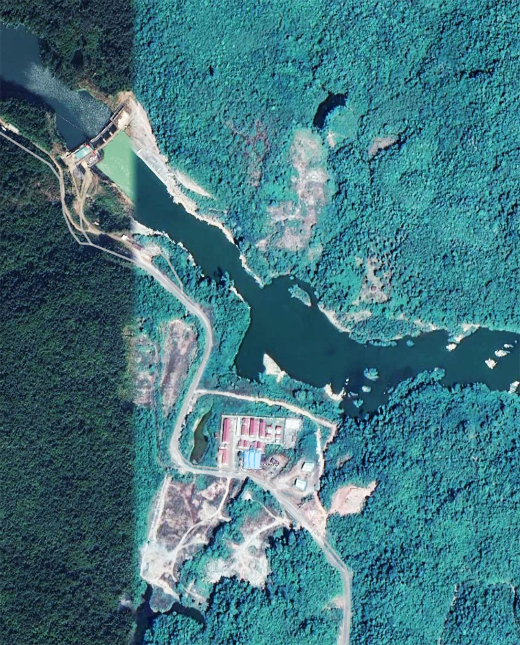
Nam Lik 1 hydropower project site below:

POSCO Engineering & Construction Co. Ltd. rendered engineering, procurement and construction (EPC) services for the project. Korea Western Power is the Operating and Maintenance (O&M) contractor for the project.
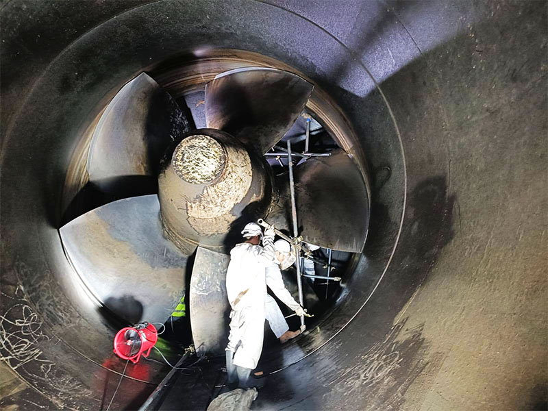
Andritz Hydro provided and installed the electro-mechanical equipment for the project which included two 32.25 MW bulb turbines, horizontal generators, mechanical auxiliaries, electric power systems, gates and additional equipment.
Nam Lik 1 is a run-of-river project. Although the maximum surface area of the reservoir is 11.5 square km, this is only 7 square km more than the regular high water surface area of the river in the wet season. The river in this area has been converted into a narrow and deep reservoir.
The Nam Lik drainage basin area covers 1,588 square kilometers.
Nam Lik 1 project location shown on basin map below:

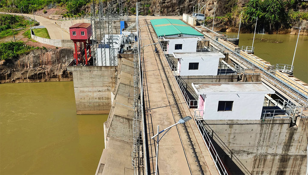
The powerhouse has two Andritz bulb turbine units (see image below) with total installed capacity of 64.5 MW. The average energy production can be 265 GWh per year.

The layout of the project is comprised of three parts: headworks, diversion works and power station structures.
The headworks consist of the retaining dam and water intakes.
Diversion works consist of headrace tunnel, surge chamber and penstock.

The power station structures are main and auxiliary powerhouses and switch yard.
The project has a surface powerhouse located on the right side. The layout includes a tunnel diversion and a four-gate spillway that can safely discharge extreme flood waters.
The penstock length is 100 meters with diameter of 6.6 meters.
On the map below the red line is the narrow Nam Lik 1 reservoir while the orange line is the Nam Lik river downstream of the dam.

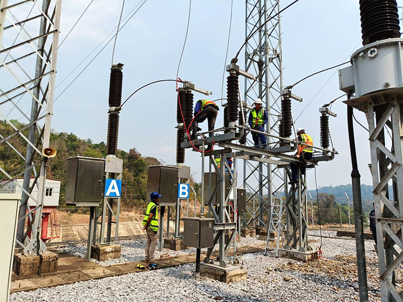
The switchyard is located beside the powerhouse and connects to a single-circuit 11 km-long 115 kV transmission line going to the Hin Heup substation.
About 112 affected families from three villages in Hinheup district were compensated for the effects of the project on their property.
Motorists and railway passengers pass over the reservoir when they cross one of the Hin Heup bridges over the Nam Lik river on Highway 13. The reservoir surface is now almost up to the bridges all year long whereas in the past the river surface was far below the bridges in the dry season.
More Nam Lik 1 hydropower project images below:


Nam Lik 1 dam satellite image below:

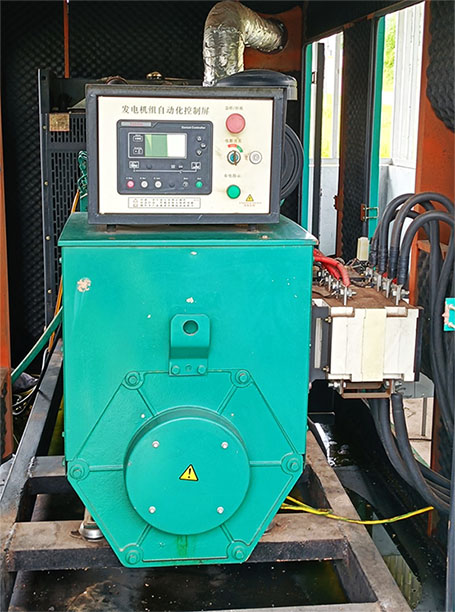
Nam Lik 1 emergency generator image below:
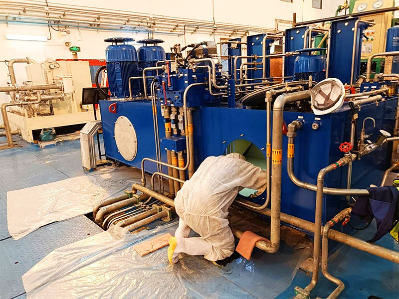
Nam Lik 1 annual maintenance images below:


See location of the project at left side of map below:
Nam Lik 1 hydropower project area image below:

The Nam Lik 1 hydropower project is intended to qualify as a Clean Development Mechanism (CDM) project under the Kyoto Protocol and be eligible to receive carbon reduction credits. Annual average CO2 reductions over the crediting period are estimated to be 122,145 tons. See the CDM application PDF document HERE.