Nam Ao-Nam Pot Hydropower Info by Hobo Maps - Go to Hydropower Projects Web Page - - - HOME
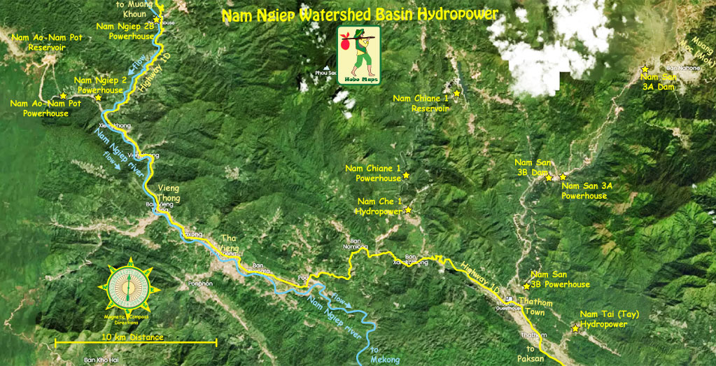
The Nam Ao-Nam Pot Hydropower project is located near the junction of the Nam Pot and Nam Siam (rivers) and near Ban Pha village, Phaxay District, Xieng Khouang Province, northern Lao PDR.
The project is sometimes referred to as the Nam Ao (Nam Aow) project and in older times as the Nam Pot project - we combine both names for combined reference.
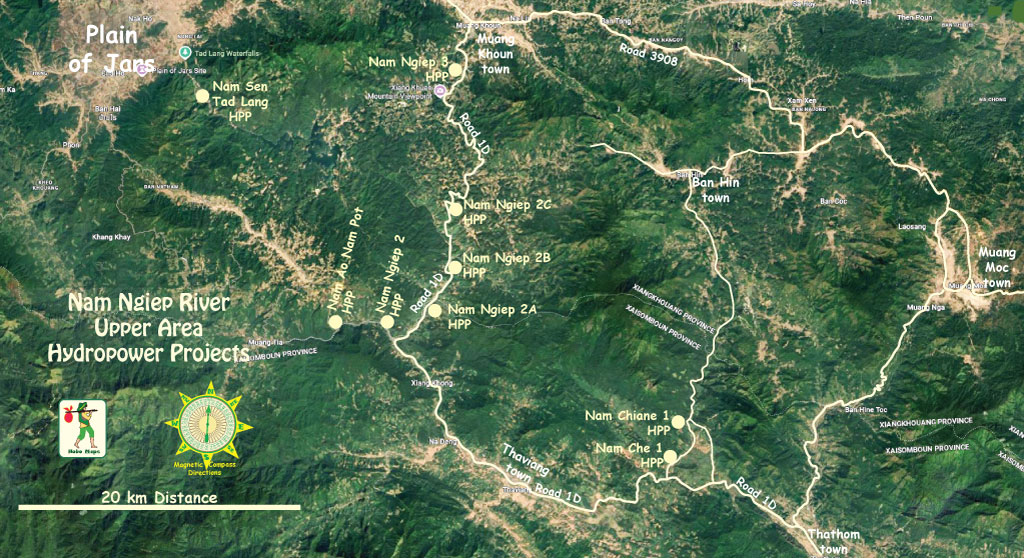
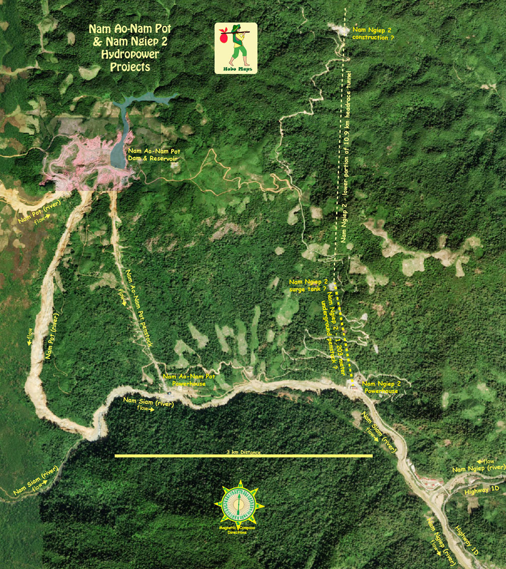
Nam Ao Nam Pot HPP location is seen at the mid section of Nam Ngiep upper area map below:
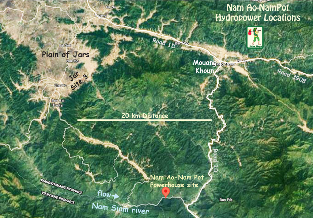
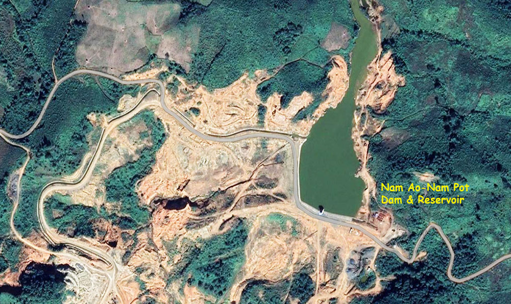
Nam Ao-Nam Pot Dam and Reservoir location coordinates - 19°09'39.0"N 103°17'01.0"E (19.160833, 103.283611) - on satellite images below:
Nam Pot river is a tributary of the Nam Siam that merges into the Nam Ngiep which joins the Mekong River near Paksan, Lao PDR.
We are guessing where the Nam Ao river might be in the image below.
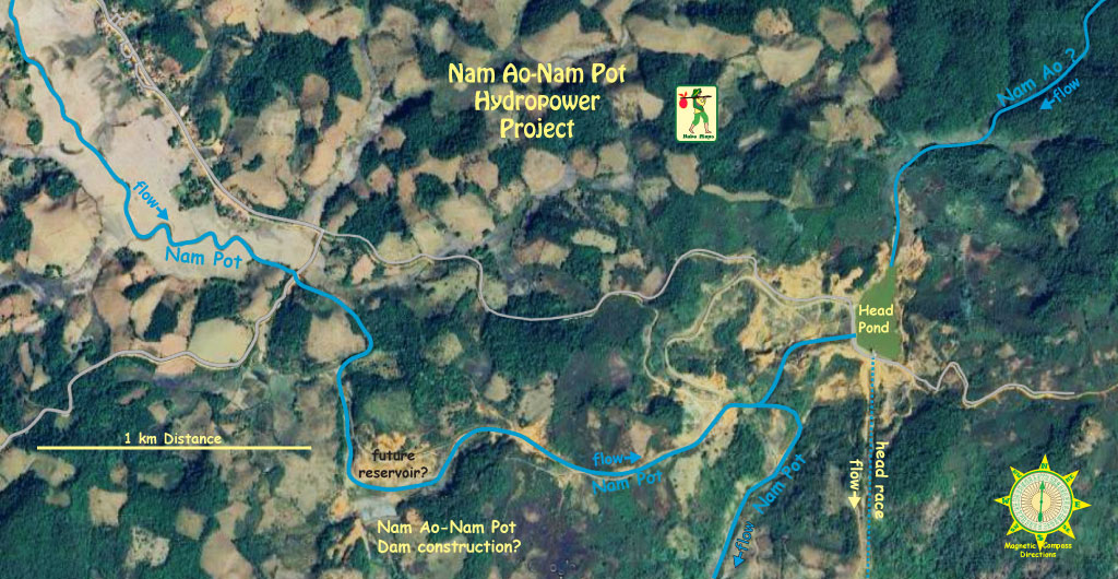
Also guessing that the construction activity in yellow area below is for a new dam and reservoir at coordinates 19°09'18.7"N 103°15'58.9"E (19.155180, 103.266356).

Nam Ao-Nam Pot Dam & Head Pond satellite image below:
The project was studied by Knight Piesold in 1997. Development permission about the same time was awarded to VKS of India but the project became inactive and was cancelled.
Lao-based Bothong Inter Company Ltd. took over the US$ 30 million project and started construction in October 2015 but the project was delayed in 2017 by a flooding accident when the project was about 85% complete.
The project is apparently being undertaken by a privately-owned company and managed by local investors. In 2026 we still aren't sure if the project has been fully completed.
Electricity generated from the project is planned to be sold to Electricite du Laos (EDL) for domestic consumption.
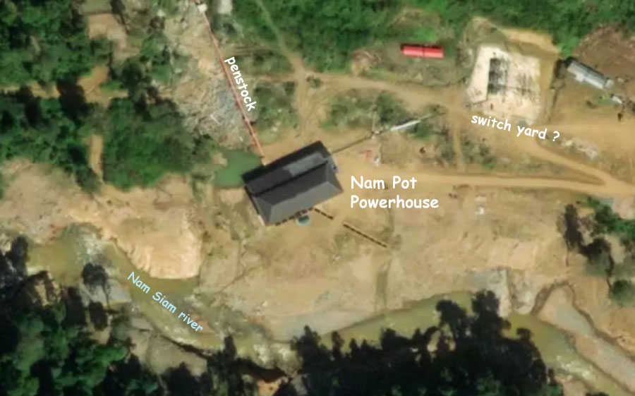
The dam structure and reservoir are located 3.5 km upstream from where the Nam Pot river merges into the Nam Siam river. Downstream of the dam and reservoir, the Nam Pot river falls 700 meters in elevation to the powerhouse.
The project has 15 MW installed capacity with about 700 meters head that may generate about 60 GWh output annually.
Nam Ao-Nam Pot powerhouse location coordinates are -19°08'15.1"N 103°17'22.8"E (19.137528, 103.289667) - on satellite images below:

Reservoir surface full supply level is to be at 1,140 meters above sea level while minimum operating level is at 1,127 meters above sea level.
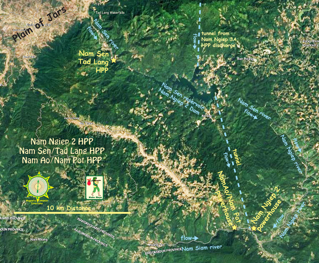
Nam Ao-Nam Pot hydropower project layout image below:
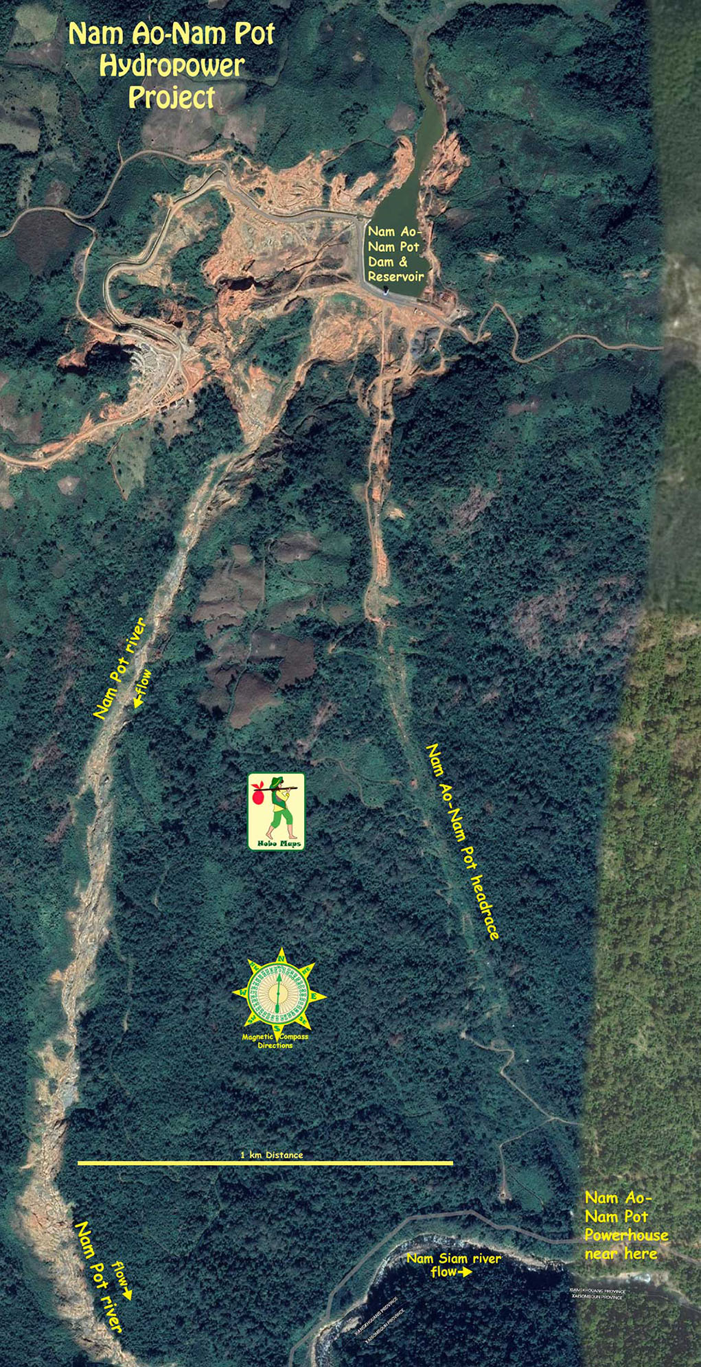
Nam Ao-Nam Pot & Nam Ngiep 2 area maps below shows both powerhouses only 2.5 km distance apart on the Nam Siam river:

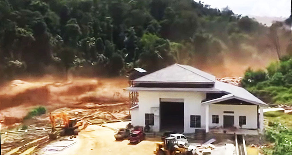
On Sept. 11, 2017 while under construction and during heavy rains, a Nam Ao-Nam Pot subsidiary dam (probably for the head pond) broke and floodwaters flowed into the powerhouse construction site doing extensive damage. The flood also caused damage downriver to the unrelated Nam Ngiep 2 hydropower project and to National Road 1D causing its temporary closure. 8 villages and agricultural lands were also flooded.
Image below and video of the flood near the construction site can be seen.
Nam Ao-Nam Pot Hyropower project planning details below from a 2004 preliminary study document that is no longer reliable.